MyTopo
Bain Minnesota US Topo Map
Couldn't load pickup availability
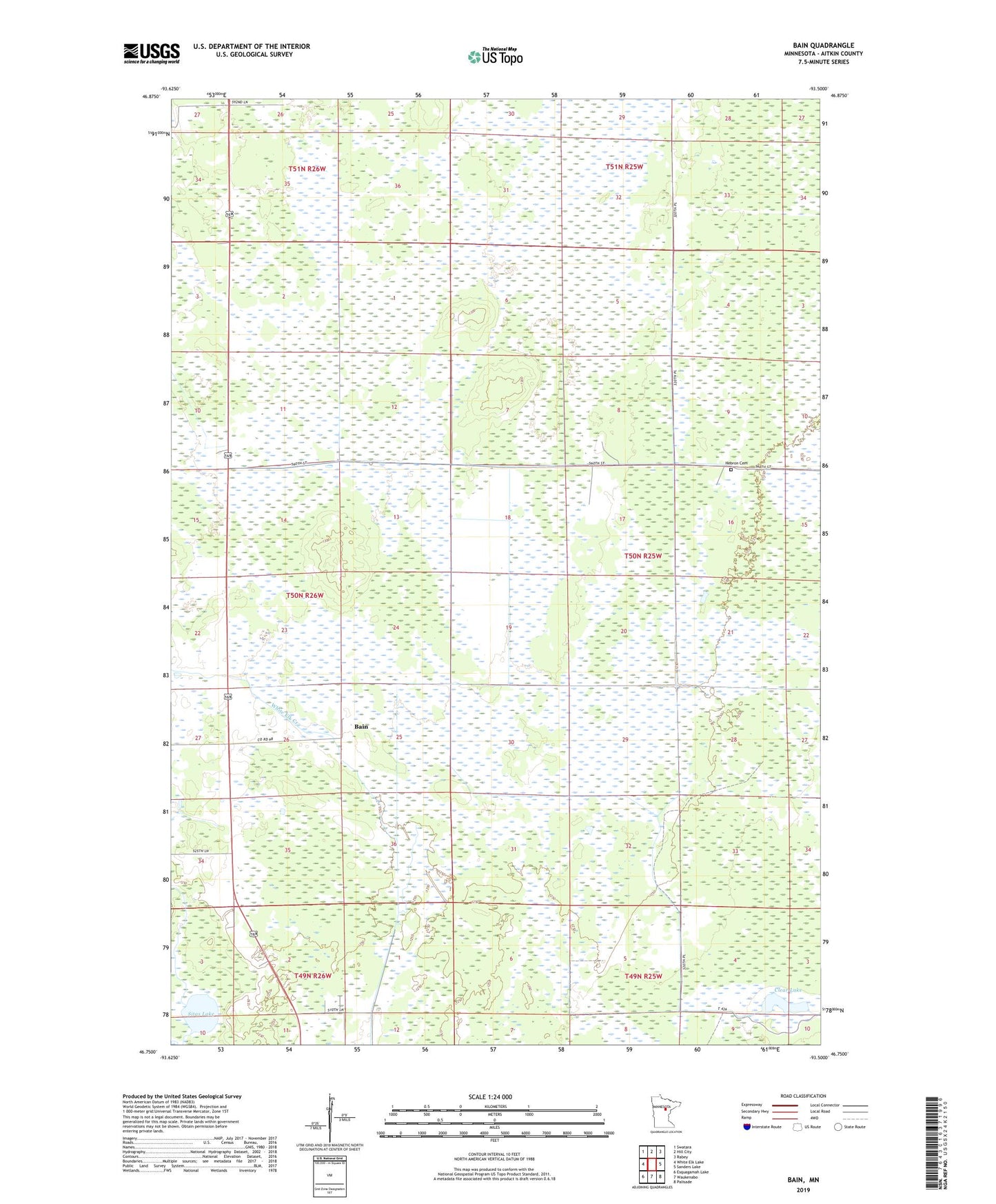
2022 topographic map quadrangle Bain in the state of Minnesota. Scale: 1:24000. Based on the newly updated USGS 7.5' US Topo map series, this map is in the following counties: Aitkin. The map contains contour data, water features, and other items you are used to seeing on USGS maps, but also has updated roads and other features. This is the next generation of topographic maps. Printed on high-quality waterproof paper with UV fade-resistant inks.
Quads adjacent to this one:
West: White Elk Lake
Northwest: Swatara
North: Hill City
Northeast: Rabey
East: Sanders Lake
Southeast: Palisade
South: Waukenabo
Southwest: Esquagamah Lake
This map covers the same area as the classic USGS quad with code o46093g5.
Contains the following named places: Bain, Clear Lake, Hebron Cemetery, Sitas Lake, ZIP Code: 56469