MyTopo
Floodwood Lake Minnesota US Topo Map
Couldn't load pickup availability
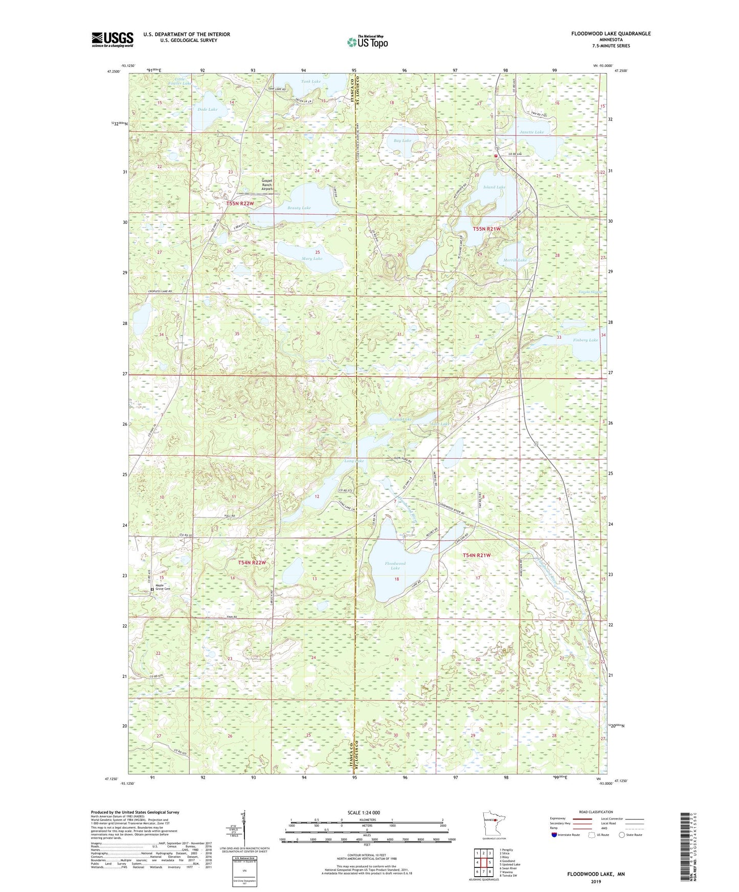
2019 topographic map quadrangle Floodwood Lake in the state of Minnesota. Scale: 1:24000. Based on the newly updated USGS 7.5' US Topo map series, this map is in the following counties: St. Louis, Itasca. The map contains contour data, water features, and other items you are used to seeing on USGS maps, but also has updated roads and other features. This is the next generation of topographic maps. Printed on high-quality waterproof paper with UV fade-resistant inks.
Quads adjacent to this one:
West: Goodland
Northwest: Pengilly
North: Silica
Northeast: Riley
East: Upstead Lake
Southeast: Toivola SW
South: Wawina
Southwest: Swan River
Contains the following named places: Bay Lake, Beauty Lake, Cropless Lake, Dode Lake, Finberg Lake, Floodwood Lake, Floodwood Lake Dam, Gospel Ranch Airport, Island Lake, Janet Lake Wayside Park, Janette Lake, Long Lake, Lost Lake, Maple Grove Cemetery, Mary Lake, Merrill Lake, Round Lake, Silica Volunteer Fire Department and First Responders, Tank Lake, Thunderbird Lake, Unorganized Territory of Janette Lake