
MyTopo
Frogner Minnesota US Topo Map
Couldn't load pickup availability
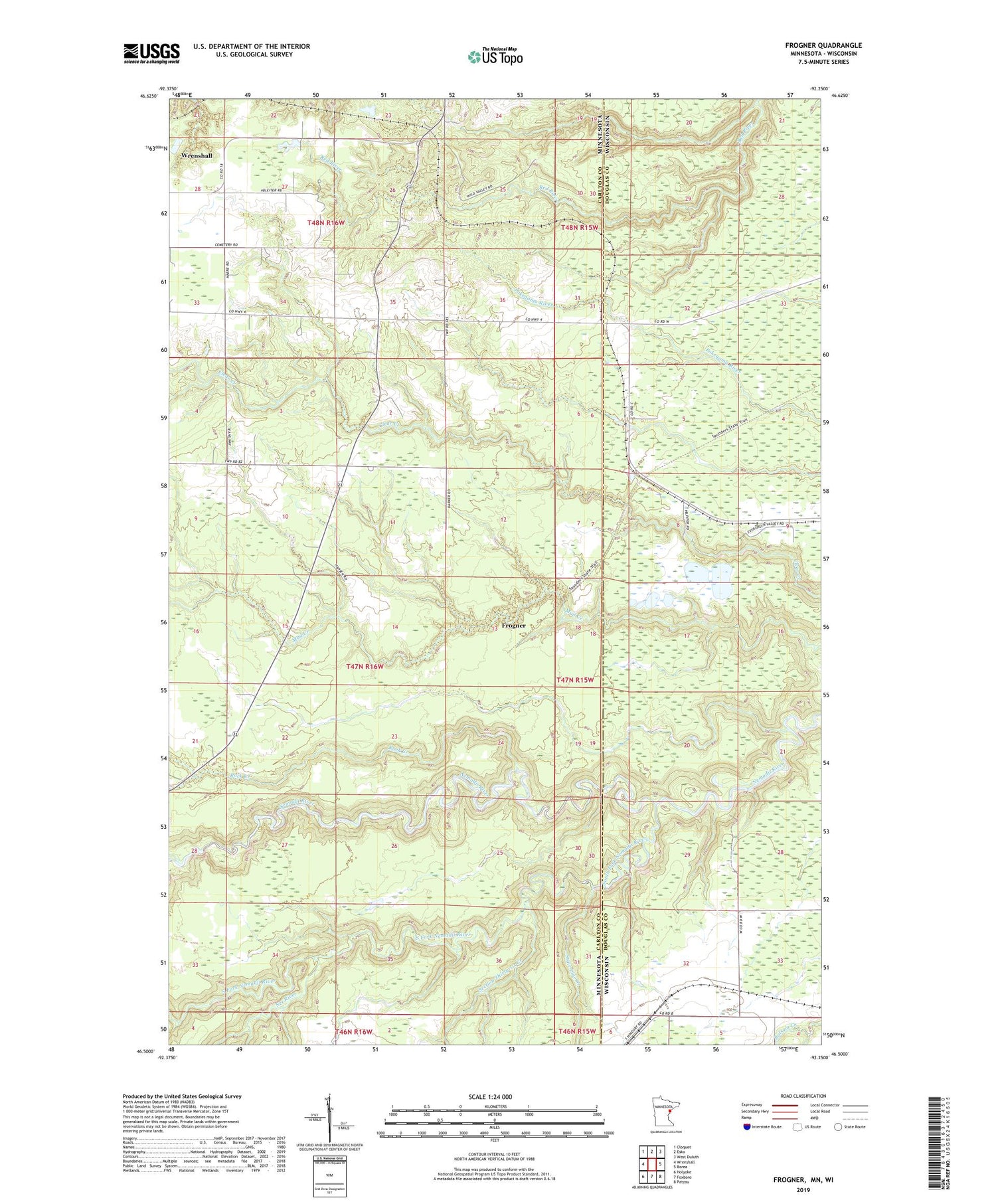
2019 topographic map quadrangle Frogner in the states of Minnesota, Wisconsin. Scale: 1:24000. Based on the newly updated USGS 7.5' US Topo map series, this map is in the following counties: Carlton, Douglas. The map contains contour data, water features, and other items you are used to seeing on USGS maps, but also has updated roads and other features. This is the next generation of topographic maps. Printed on high-quality waterproof paper with UV fade-resistant inks.
Quads adjacent to this one:
West: Wrenshall
Northwest: Cloquet
North: Esko
Northeast: West Duluth
East: Borea
Southeast: Patzau
South: Foxboro
Southwest: Holyoke
Contains the following named places: Barker, Barker Post Office, Deer Creek, Foxboro School, Frogner, Little Net River, Net River, Rock Creek, Section Thirty-six Creek, South Fork Nemadji River, State Line, State Line Creek, Township of Silver Brook, Township of Wrenshall, ZIP Code: 55797


