MyTopo
Wrenshall Minnesota US Topo Map
Couldn't load pickup availability
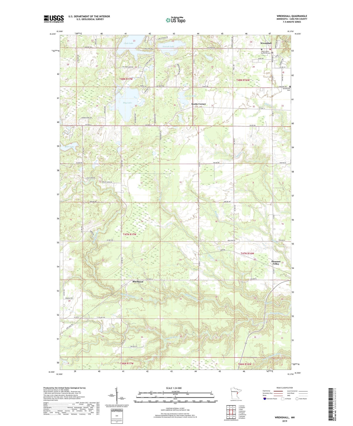
2022 topographic map quadrangle Wrenshall in the state of Minnesota. Scale: 1:24000. Based on the newly updated USGS 7.5' US Topo map series, this map is in the following counties: Carlton. The map contains contour data, water features, and other items you are used to seeing on USGS maps, but also has updated roads and other features. This is the next generation of topographic maps. Printed on high-quality waterproof paper with UV fade-resistant inks.
Quads adjacent to this one:
West: Atkinson
Northwest: Iverson
North: Cloquet
Northeast: Esko
East: Frogner
Southeast: Foxboro
South: Holyoke
Southwest: Nickerson
This map covers the same area as the classic USGS quad with code o46092e4.
Contains the following named places: Bandle's Mobile Home Park, Bear Lake, Blackhoof, Blackhoof Post Office, Blackhoof River, Chub Lake, City of Wrenshall, First Presbyterian Church, Hay Lake, Lac La Belle, Moehrke Pond, Moehrke SCS Dam, Pioneer Park Mobile Home Park, Pleasant Valley, Saint John's Lutheran Cemetery, Saint John's Lutheran Church, Scotts Corner, Silverbrook Cemetery, Son of Life Community Church, Township of Blackhoof, Venoah Lake, Walter Hackensmith Fishpond Dam, Wrenshall, Wrenshall Fire Department, Wrenshall High School, Wrenshall Police Department, Wrenshall Post Office, ZIP Code: 55718