MyTopo
Holyoke Minnesota US Topo Map
Couldn't load pickup availability
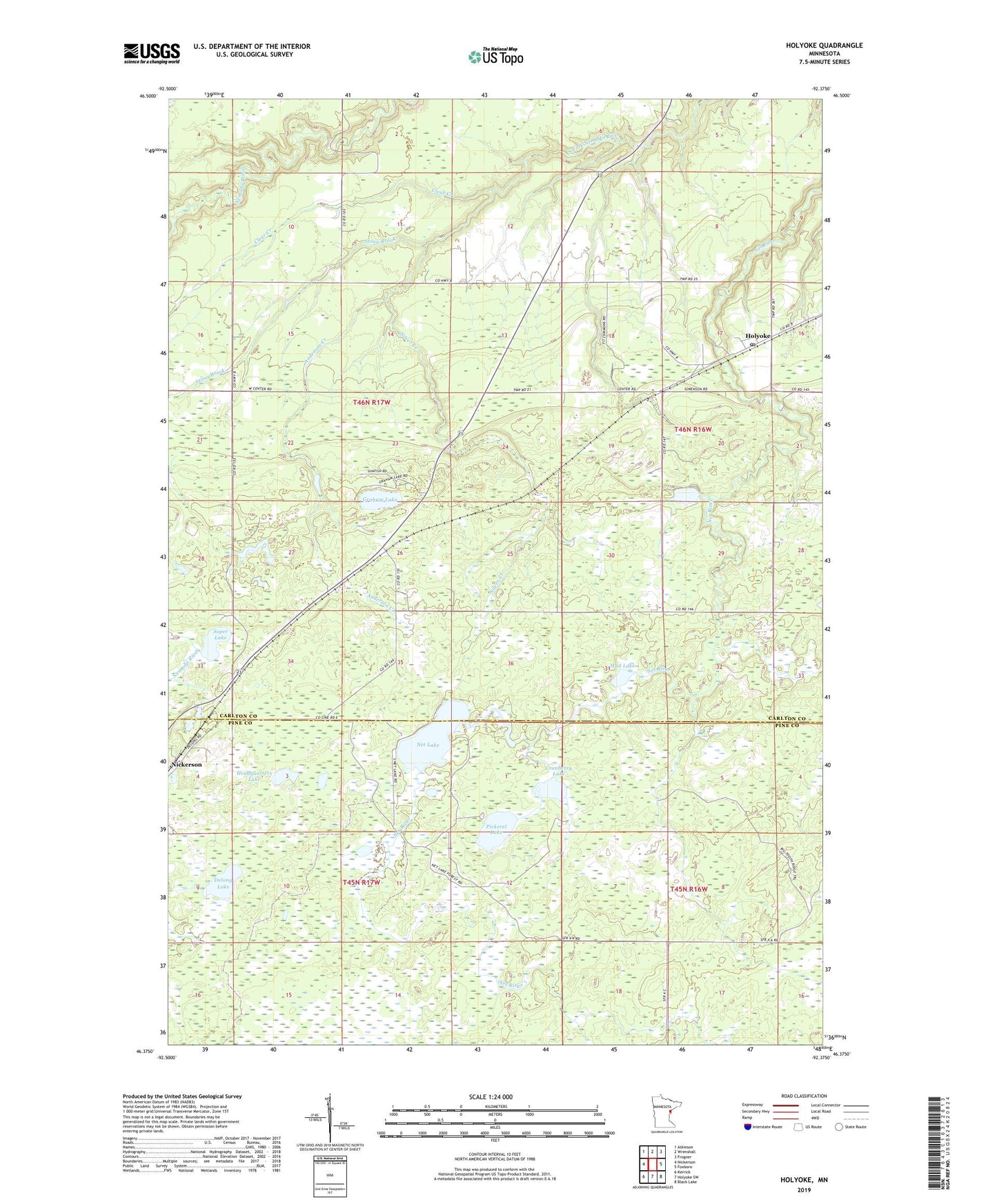
2022 topographic map quadrangle Holyoke in the state of Minnesota. Scale: 1:24000. Based on the newly updated USGS 7.5' US Topo map series, this map is in the following counties: Carlton, Pine. The map contains contour data, water features, and other items you are used to seeing on USGS maps, but also has updated roads and other features. This is the next generation of topographic maps. Printed on high-quality waterproof paper with UV fade-resistant inks.
Quads adjacent to this one:
West: Nickerson
Northwest: Atkinson
North: Wrenshall
Northeast: Frogner
East: Foxboro
Southeast: Black Lake
South: Holyoke SW
Southwest: Kerrick
This map covers the same area as the classic USGS quad with code o46092d4.
Contains the following named places: Anderson Creek, Clear Creek, Cranberry Lake, Delong Lake, Gafvert Campground, Graham Lake, Graham Lake Wayside Park, Headquarters Lake, Herman Mader Pond Dam, Holyoke, Holyoke Post Office, Mud Lake, Nemadji Creek, Net Lake, Nickerson, Pickerel Lake, Silver Creek, Soper Lake, Stony Brook, Unorganized Territory of Clear Creek, ZIP Code: 55749