MyTopo
Gislason Lake Minnesota US Topo Map
Couldn't load pickup availability
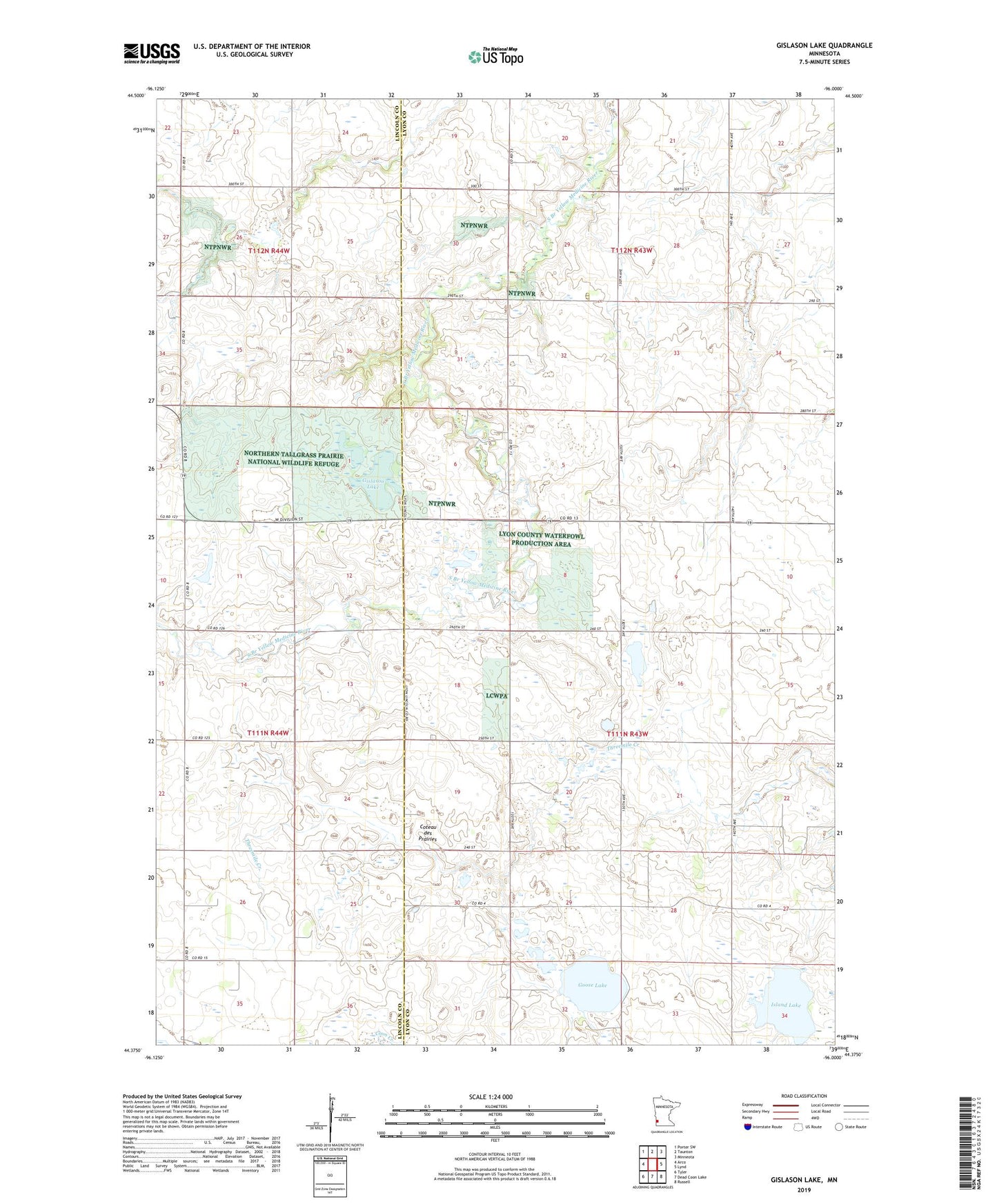
2019 topographic map quadrangle Gislason Lake in the state of Minnesota. Scale: 1:24000. Based on the newly updated USGS 7.5' US Topo map series, this map is in the following counties: Lyon, Lincoln. The map contains contour data, water features, and other items you are used to seeing on USGS maps, but also has updated roads and other features. This is the next generation of topographic maps. Printed on high-quality waterproof paper with UV fade-resistant inks.
Quads adjacent to this one:
West: Arco
Northwest: Porter SW
North: Taunton
Northeast: Minneota
East: Lynd
Southeast: Russell
South: Dead Coon Lake
Southwest: Tyler
Contains the following named places: Gislason Lake, Goose Lake, Hauschild-Thanghe Reservoir Dam, Island Lake, Northern Tallgrass Prairie National Wildlife Refuge, Township of Island Lake, Zion Church