MyTopo
Glen Minnesota US Topo Map
Couldn't load pickup availability
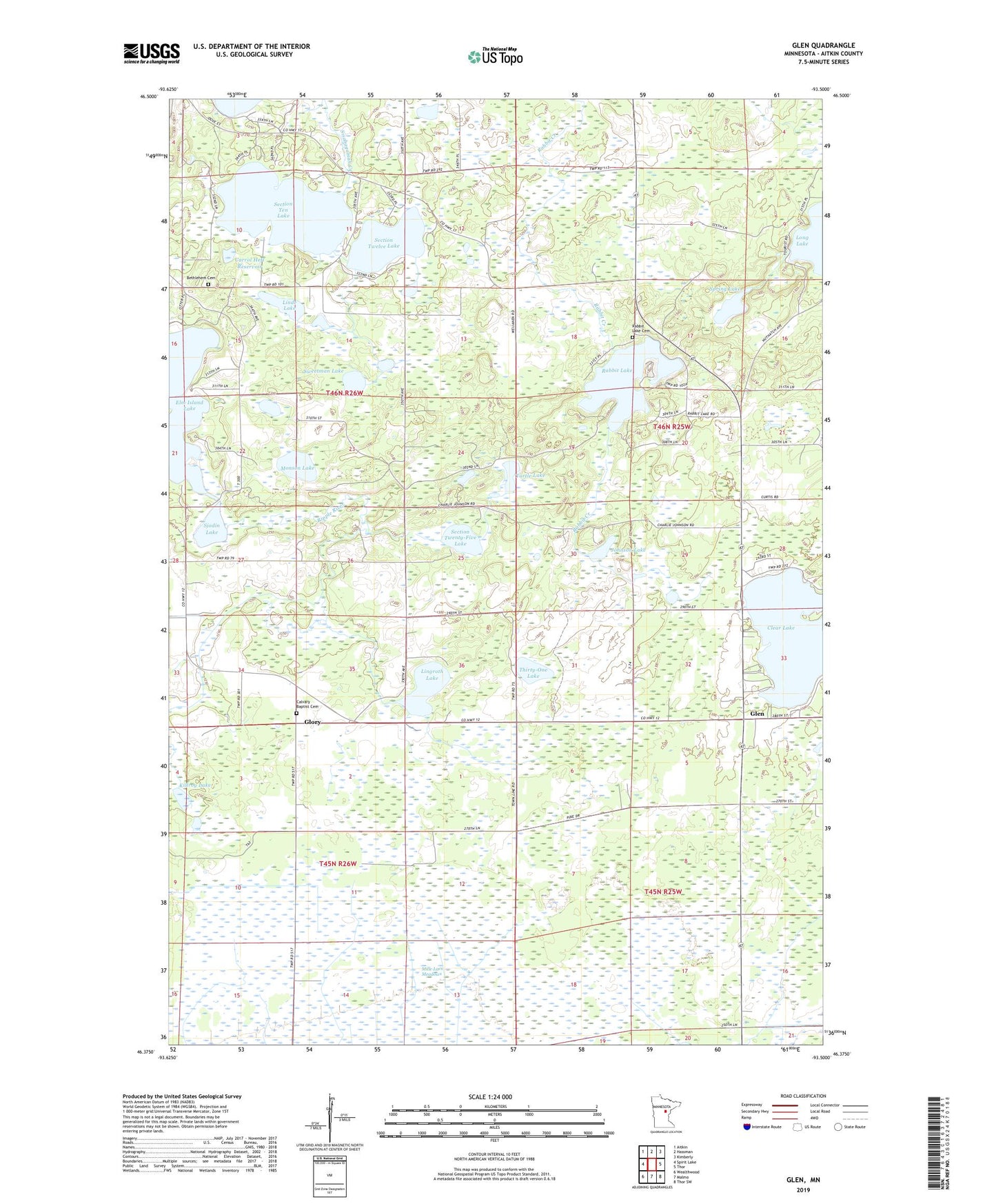
2022 topographic map quadrangle Glen in the state of Minnesota. Scale: 1:24000. Based on the newly updated USGS 7.5' US Topo map series, this map is in the following counties: Aitkin. The map contains contour data, water features, and other items you are used to seeing on USGS maps, but also has updated roads and other features. This is the next generation of topographic maps. Printed on high-quality waterproof paper with UV fade-resistant inks.
Quads adjacent to this one:
West: Spirit Lake
Northwest: Aitkin
North: Hassman
Northeast: Kimberly
East: Thor
Southeast: Thor SW
South: Malmo
Southwest: Wealthwood
This map covers the same area as the classic USGS quad with code o46093d5.
Contains the following named places: Bethlehem Church, Bethlehem Lutheran Cemetery, Calvary Baptist Cemetery, Carrol Heft Dam, Carrol Heft Reservoir, Clear Lake, Clear Lake Parish House, Glen, Glen Lookout Tower, Glen Post Office, Glory, Glory Baptist Church, Glory Post Office, Johnson Lake, Killroy Lake, Linde Lake, Lingroth Lake, Mille Lacs Meadows, Monson Lake, Rabbit Lake, Rabbit Lake Cemetery, Section Ten Lake, Section Twelve Lake, Section Twenty-Five Lake, Sjodin Lake, Spring Lake, Sweetman Lake, Thirty-One Lake, Township of Nordland, Turtle Lake, Valparaiso Post Office