MyTopo
Gracelock NE Minnesota US Topo Map
Couldn't load pickup availability
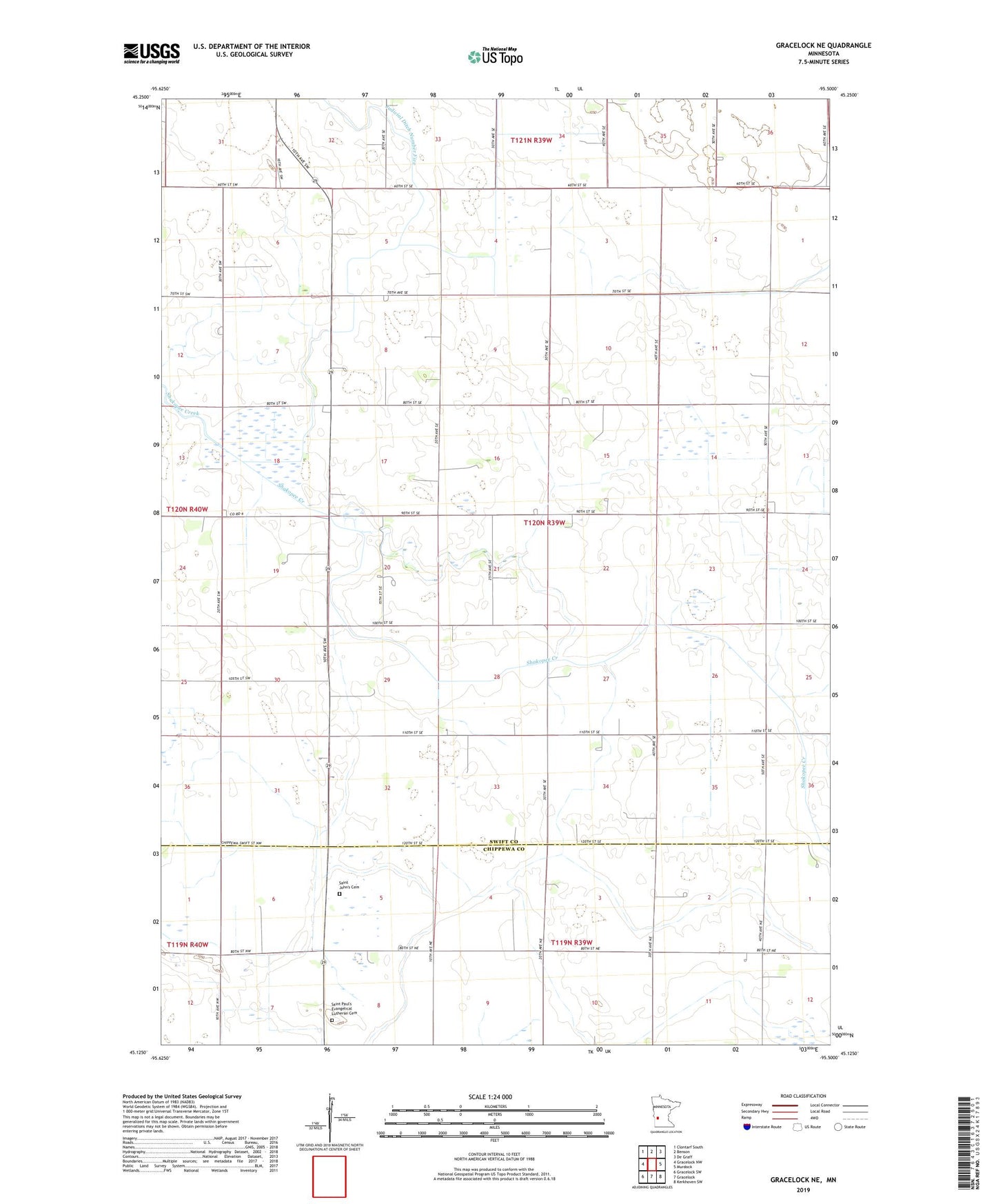
2022 topographic map quadrangle Gracelock NE in the state of Minnesota. Scale: 1:24000. Based on the newly updated USGS 7.5' US Topo map series, this map is in the following counties: Swift, Chippewa. The map contains contour data, water features, and other items you are used to seeing on USGS maps, but also has updated roads and other features. This is the next generation of topographic maps. Printed on high-quality waterproof paper with UV fade-resistant inks.
Quads adjacent to this one:
West: Gracelock NW
Northwest: Clontarf South
North: Benson
Northeast: De Graff
East: Murdock
Southeast: Kerkhoven SW
South: Gracelock
Southwest: Gracelock SW
This map covers the same area as the classic USGS quad with code o45095b5.
Contains the following named places: Molin Cemetery, Paynes Airport, Saint John's Cemetery, Saint Johns Church, Saint Paul's Evangelical Lutheran Cemetery, School Number 2193, School Number 2197, School Number 2210, School Number 2233, School Number 300, School Number 306, Township of Cashel