MyTopo
Gracelock SW Minnesota US Topo Map
Couldn't load pickup availability
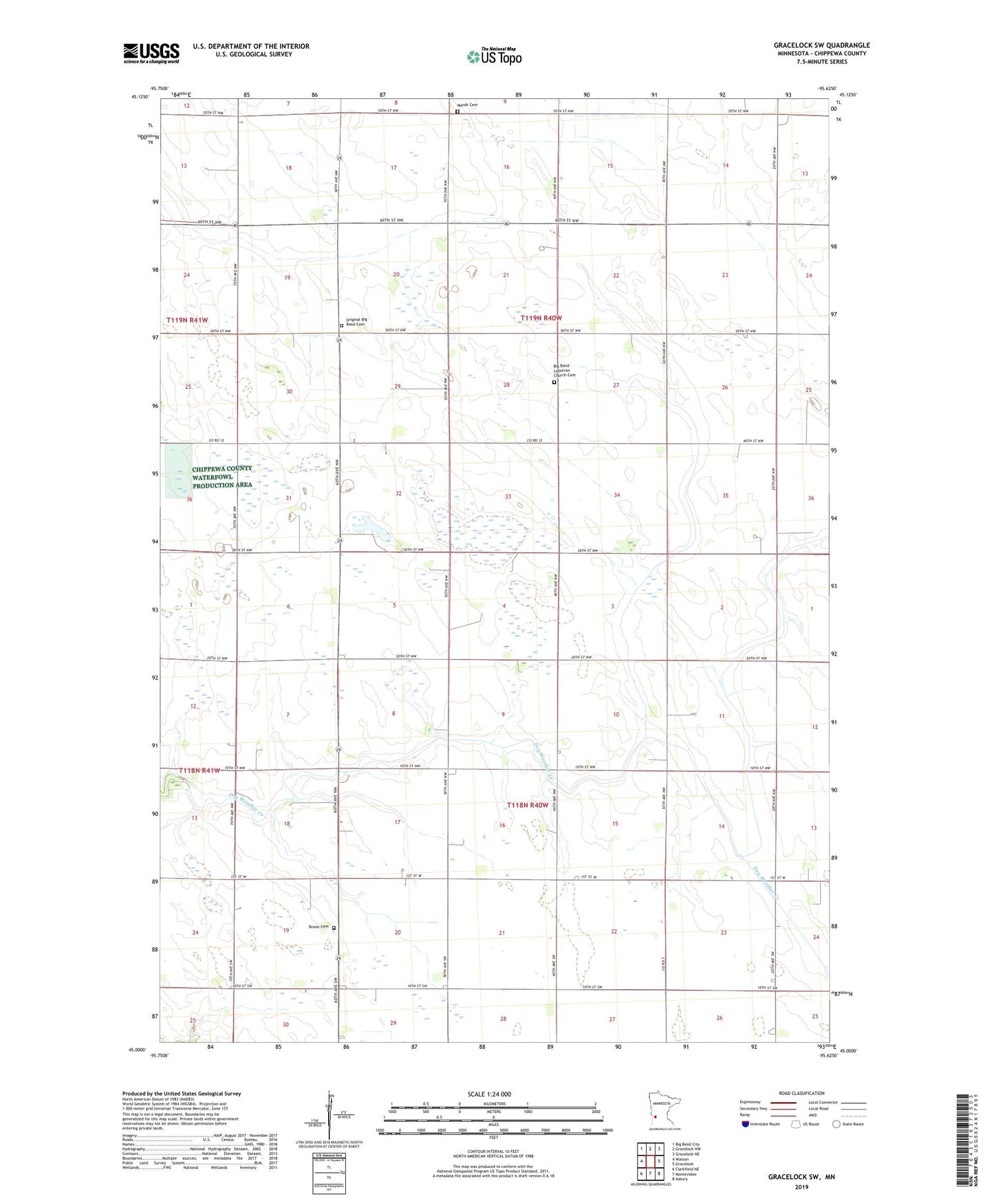
2022 topographic map quadrangle Gracelock SW in the state of Minnesota. Scale: 1:24000. Based on the newly updated USGS 7.5' US Topo map series, this map is in the following counties: Chippewa. The map contains contour data, water features, and other items you are used to seeing on USGS maps, but also has updated roads and other features. This is the next generation of topographic maps. Printed on high-quality waterproof paper with UV fade-resistant inks.
Quads adjacent to this one:
West: Watson
Northwest: Big Bend City
North: Gracelock NW
Northeast: Gracelock NE
East: Gracelock
Southeast: Asbury
South: Montevideo
Southwest: Clarkfield NE
This map covers the same area as the classic USGS quad with code o45095a6.
Contains the following named places: Brono Cemetery, Javnaker Church, Mandt Cemetery, Mandt Church, Original Big Bend Cemetery, School Number 290, School Number 291, School Number 294, School Number 296, School Number 310, School Number 313, Township of Mandt, Township of Rosewood