MyTopo
Hallock Minnesota US Topo Map
Couldn't load pickup availability
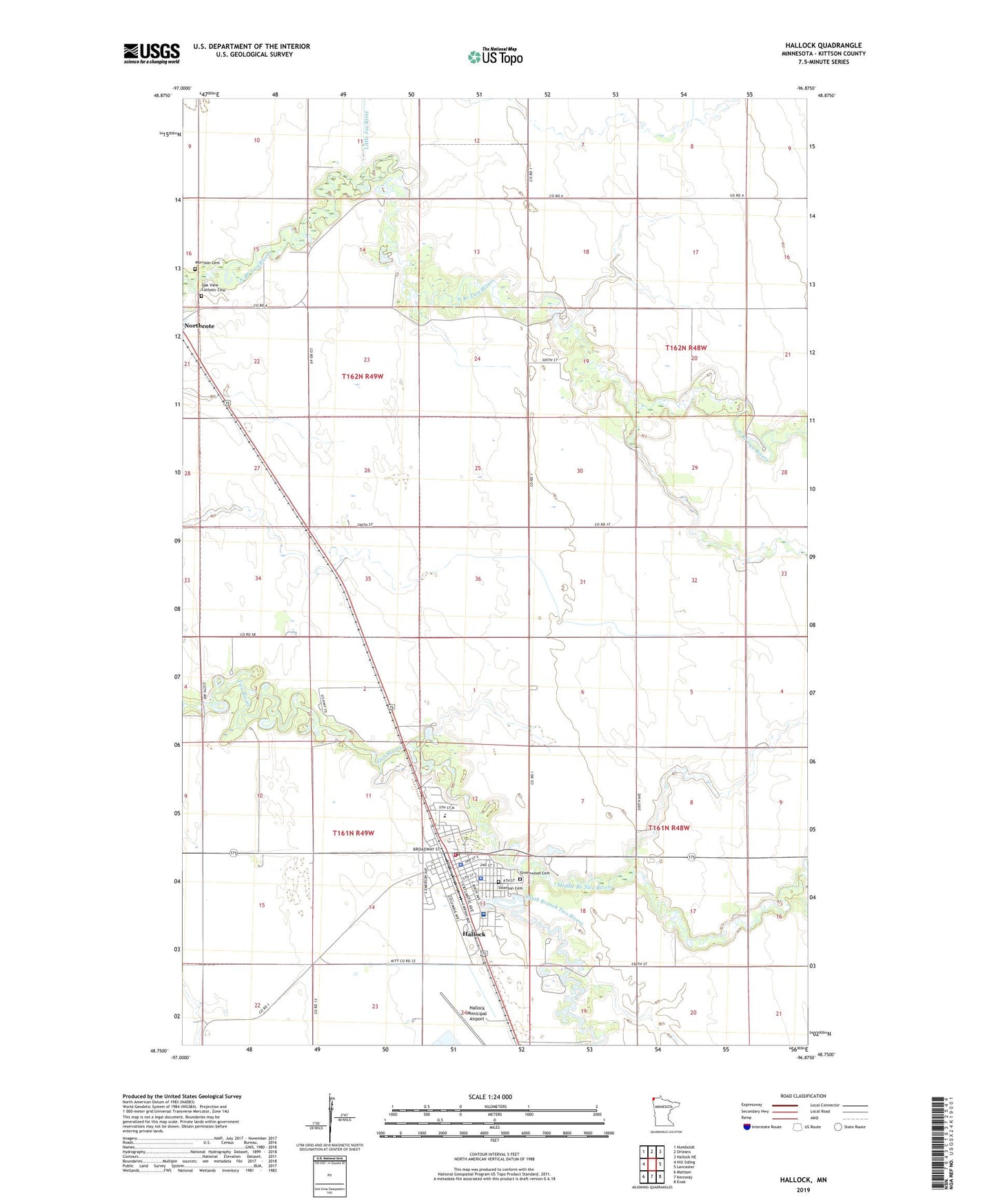
2022 topographic map quadrangle Hallock in the state of Minnesota. Scale: 1:24000. Based on the newly updated USGS 7.5' US Topo map series, this map is in the following counties: Kittson. The map contains contour data, water features, and other items you are used to seeing on USGS maps, but also has updated roads and other features. This is the next generation of topographic maps. Printed on high-quality waterproof paper with UV fade-resistant inks.
Quads adjacent to this one:
West: Hill Siding
Northwest: Humboldt
North: Orleans
Northeast: Hallock NE
East: Lancaster
Southeast: Enok
South: Kennedy
Southwest: Mattson
This map covers the same area as the classic USGS quad with code o48096g8.
Contains the following named places: Assembly of God Church, City of Hallock, Grace Lutheran Church, Grasshopper School, Greenwood Cemetery, Hallock, Hallock City Public Library, Hallock Fire Department, Hallock Mission Covenant Church, Hallock Municipal Airport, Hallock Police Department, Hallock Post Office, Hallock Station, Jerome School, Kittson Central High School, Kittson County Jail, Kittson County Sheriff's Office, Kittson County Volunteer Ambulance Service, Kittson Healthcare Hospital, Kittson Memorial Clinic, Little Joe River, Maurice Sugden Flying Service Strip, Middle Branch Two Rivers, Morrison Cemetery, Oak View Catholic Cemetery, Presbyterian Church, Rocket Speedway, Saint Patrick's Catholic Church, South Branch Two Rivers, Swanson Cemetery, Tourist Park, Township of Hallock, Township of Hampden, Two Rivers Dam, Viking Land Terrace, West Granville School