MyTopo
Kennedy Minnesota US Topo Map
Couldn't load pickup availability
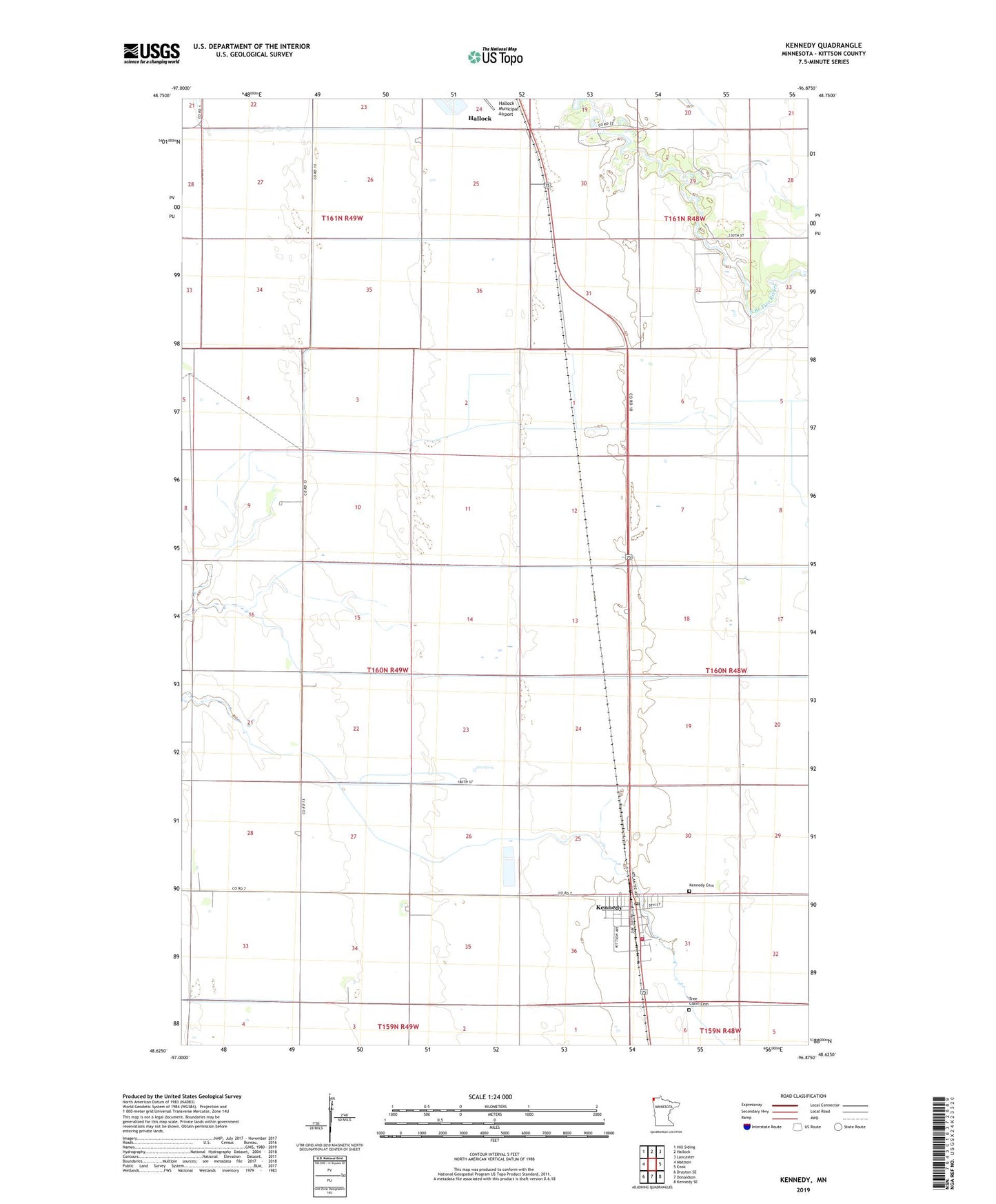
2022 topographic map quadrangle Kennedy in the state of Minnesota. Scale: 1:24000. Based on the newly updated USGS 7.5' US Topo map series, this map is in the following counties: Kittson. The map contains contour data, water features, and other items you are used to seeing on USGS maps, but also has updated roads and other features. This is the next generation of topographic maps. Printed on high-quality waterproof paper with UV fade-resistant inks.
Quads adjacent to this one:
West: Mattson
Northwest: Hill Siding
North: Hallock
Northeast: Lancaster
East: Enok
Southeast: Kennedy SE
South: Donaldson
Southwest: Drayton SE
This map covers the same area as the classic USGS quad with code o48096f8.
Contains the following named places: Chatham, City of Kennedy, County Ditch Number Eight, County Ditch Number One, County Ditch Number Twentyfive, County Ditch Number Twentyseven, Ditch School, Evangelical Covenant Church, Kennedy, Kennedy Area Fire Department, Kennedy Cemetery, Kennedy Post Office, Kittson Central Elementary School, Lukes Airport, Maria Lutheran Church, State Ditch Number One, Township of Skane, Tree Claim Cemetery, Wilson School, ZIP Code: 56733