MyTopo
Halverson Lake Minnesota US Topo Map
Couldn't load pickup availability
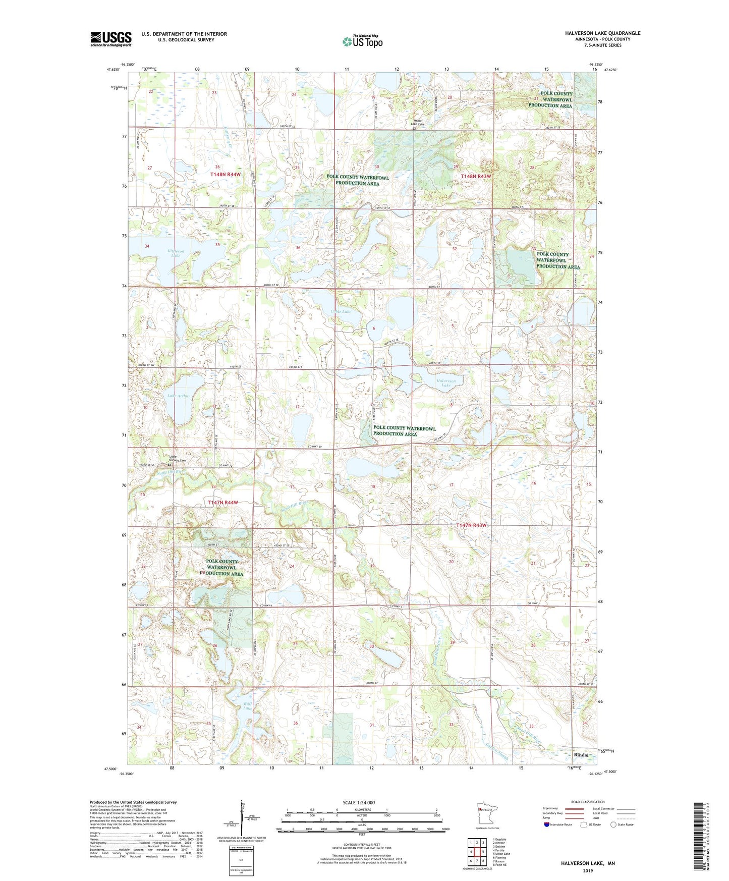
2022 topographic map quadrangle Halverson Lake in the state of Minnesota. Scale: 1:24000. Based on the newly updated USGS 7.5' US Topo map series, this map is in the following counties: Polk. The map contains contour data, water features, and other items you are used to seeing on USGS maps, but also has updated roads and other features. This is the next generation of topographic maps. Printed on high-quality waterproof paper with UV fade-resistant inks.
Quads adjacent to this one:
West: Fertile
Northwest: Dugdale
North: Mentor
Northeast: Erskine
East: Union Lake
Southeast: Faith NE
South: Ranum
Southwest: Flaming
This map covers the same area as the classic USGS quad with code o47096e2.
Contains the following named places: Cable Lake, County Ditch Number Seventeen, Faaberg Church, Garden Slough, Halverson Lake, Kittleson Lake, Lake Arthur, Little Norway Cemetery, Little Norway Church, Maple Lake Cemetery, Maple Lake Church, Raff Lake, Schulstad Lake, Township of Garden, Valley Post Office