MyTopo
Union Lake Minnesota US Topo Map
Couldn't load pickup availability
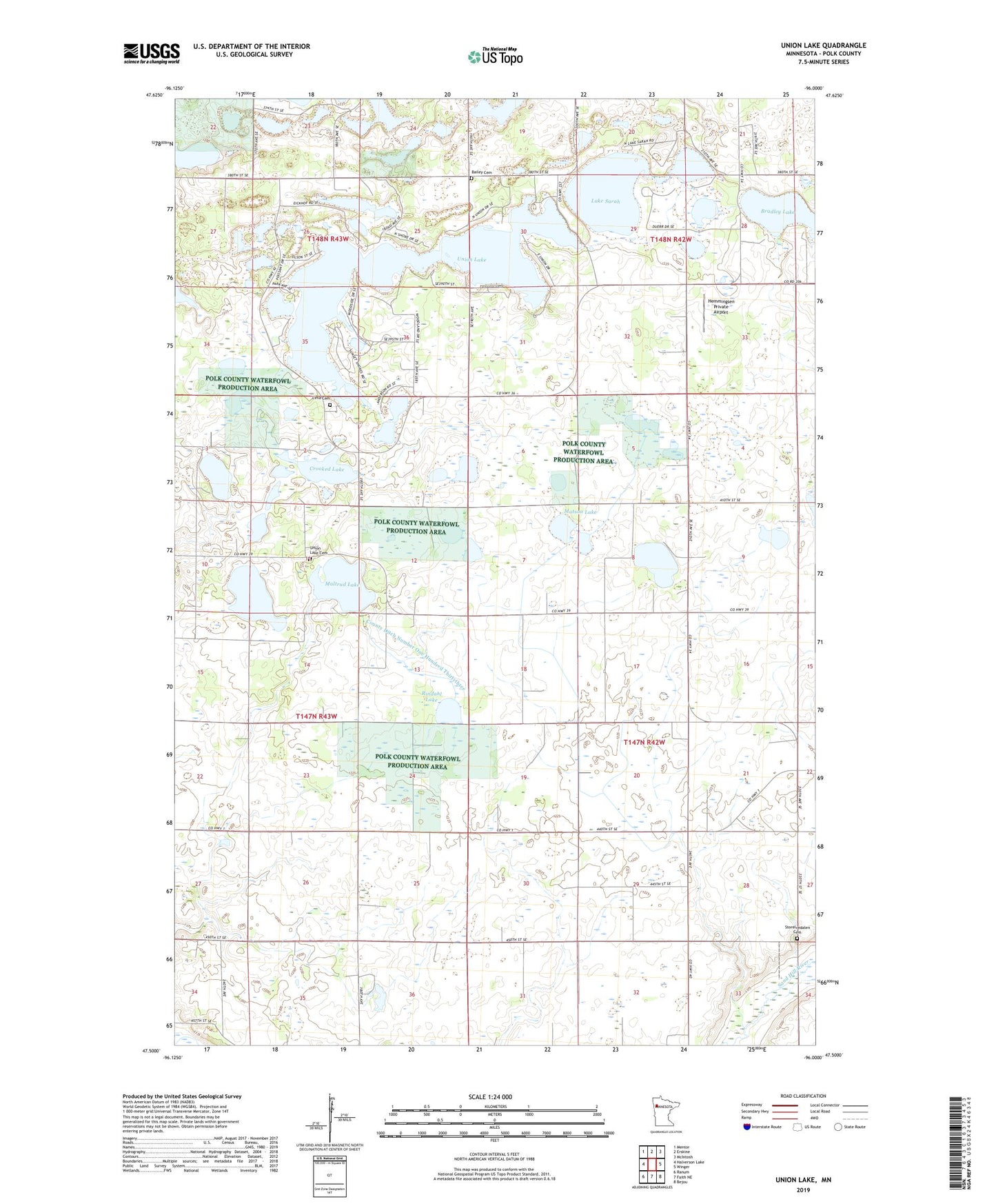
2022 topographic map quadrangle Union Lake in the state of Minnesota. Scale: 1:24000. Based on the newly updated USGS 7.5' US Topo map series, this map is in the following counties: Polk. The map contains contour data, water features, and other items you are used to seeing on USGS maps, but also has updated roads and other features. This is the next generation of topographic maps. Printed on high-quality waterproof paper with UV fade-resistant inks.
Quads adjacent to this one:
West: Halverson Lake
Northwest: Mentor
North: Erskine
Northeast: McIntosh
East: Winger
Southeast: Bejou
South: Faith NE
Southwest: Ranum
This map covers the same area as the classic USGS quad with code o47096e1.
Contains the following named places: Bailey Cemetery, Bradley Lake, County Ditch Number One Hundred Thirtythree, Crooked Lake, Farmers Union Park, Farmers Union Park Campground, Gossen Post Office, Gregg Post Office, Hemmingsen Private Airport, Lake Sarah, Lima Cemetery, Maltrud Lake, Matson Lake, Rindahl Lake, Rindahl State Wildlife Management Area, Storelvedalen Cemetery, Township of Winger, Union Lake, Union Lake Cemetery, Union Lake Church, Union Lake Sarah Campground, Woodside Post Office, ZIP Code: 56592