MyTopo
Heinola Minnesota US Topo Map
Couldn't load pickup availability
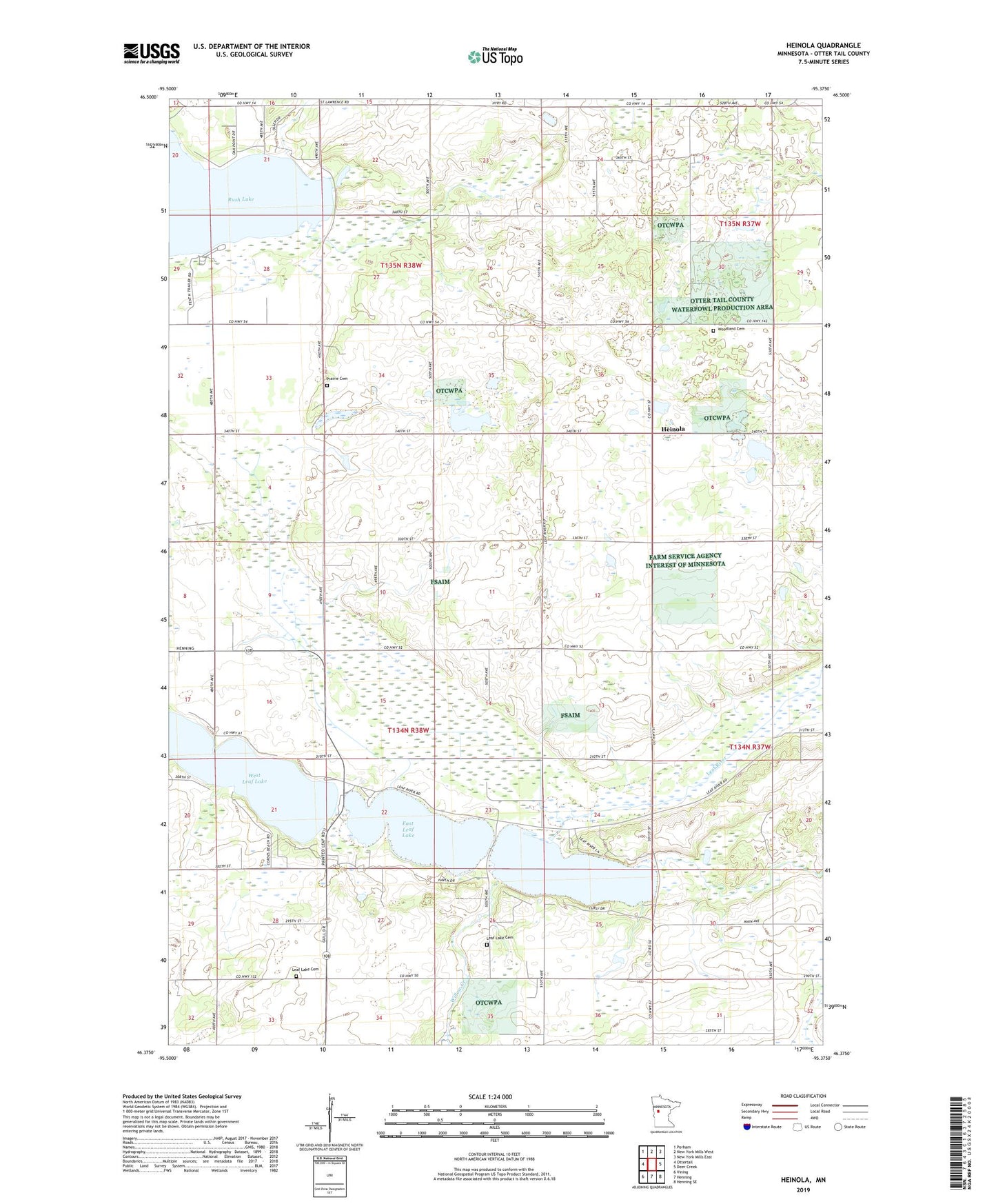
2022 topographic map quadrangle Heinola in the state of Minnesota. Scale: 1:24000. Based on the newly updated USGS 7.5' US Topo map series, this map is in the following counties: Otter Tail. The map contains contour data, water features, and other items you are used to seeing on USGS maps, but also has updated roads and other features. This is the next generation of topographic maps. Printed on high-quality waterproof paper with UV fade-resistant inks.
Quads adjacent to this one:
West: Ottertail
Northwest: Perham
North: New York Mills West
Northeast: New York Mills East
East: Deer Creek
Southeast: Henning SE
South: Henning
Southwest: Vining
This map covers the same area as the classic USGS quad with code o46095d4.
Contains the following named places: East Leaf Lake, Heinola, Leaf City, Leaf City Historical Marker, Leaf Lake Cemetery, Leaf Lake Church, Prairie Cemetery, Rush Lake Tent and Trailer Camp, School Number 135, Township of Leaf Lake, Township of Otto, West Leaf Lake, Willow Creek, Woodland Cemetery