MyTopo
Henderson Minnesota US Topo Map
Couldn't load pickup availability
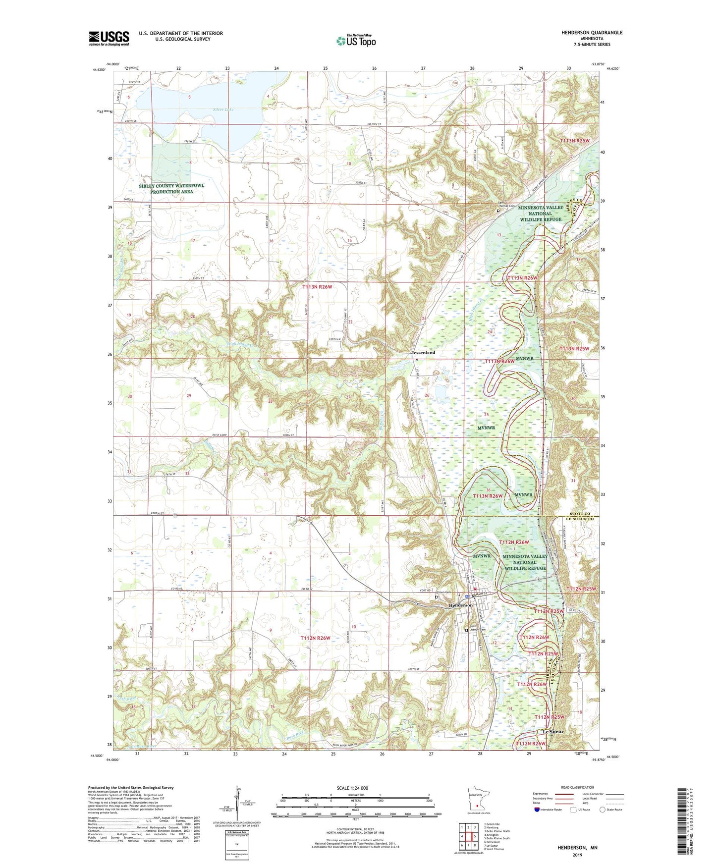
2019 topographic map quadrangle Henderson in the state of Minnesota. Scale: 1:24000. Based on the newly updated USGS 7.5' US Topo map series, this map is in the following counties: Sibley, Scott, Le Sueur. The map contains contour data, water features, and other items you are used to seeing on USGS maps, but also has updated roads and other features. This is the next generation of topographic maps. Printed on high-quality waterproof paper with UV fade-resistant inks.
Quads adjacent to this one:
West: Arlington
Northwest: Green Isle
North: Hamburg
Northeast: Belle Plaine North
East: Belle Plaine South
Southeast: Saint Thomas
South: Le Sueur
Southwest: Norseland
Contains the following named places: Allansons Park, Brown Cemetery, Buffalo Creek, Centennial Lutheran Church, City of Henderson, County Ditch Number Fortyfive, County Ditch Number Thirty A, Henderson, Henderson Fire Department, Henderson Jehovahs Witnesses, Henderson Police Department, Henderson Post Office, Henderson Public Library, Henderson Station, High Island Creek, High Island Creek County Park, High Island Creek Dam, Hilltop School, Jessen Land Post Office, Jessenland, Joseph R Brown State Monument, Minnesota New Country School, Rush River, Rush River State Wayside, Saint Joseph Parish, Saint Josephs Cemetery, Saint Paul's United Church of Christ, Saint Thomas Cemetery, Saint Thomas Church, Sibley County Historical Museum, Sibley Estates East, Silver Lake, South Branch Rush River, Township of Henderson, Township of Jessenland, ZIP Code: 56044