MyTopo
High Landing Minnesota US Topo Map
Couldn't load pickup availability
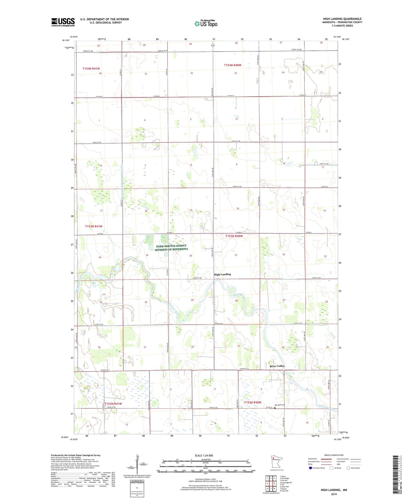
2022 topographic map quadrangle High Landing in the state of Minnesota. Scale: 1:24000. Based on the newly updated USGS 7.5' US Topo map series, this map is in the following counties: Pennington. The map contains contour data, water features, and other items you are used to seeing on USGS maps, but also has updated roads and other features. This is the next generation of topographic maps. Printed on high-quality waterproof paper with UV fade-resistant inks.
Quads adjacent to this one:
West: Goodridge SW
Northwest: Mavie
North: Goodridge
Northeast: Erie NW
East: Erie
Southeast: Gully NW
South: Roland
Southwest: Oklee NW
This map covers the same area as the classic USGS quad with code o48095a7.
Contains the following named places: Brunkeberg Post Office, County Ditch Number Fiftyone, County Ditch Number Fiftythree, County Ditch Number Fortyone, County Ditch Number Fortyseven, County Ditch Number Thirtynine A, High Landing, High Landing Post Office, Kuehnel Post Office, Malone Post Office, Oak Park Cemetery, Oak Park Church, River Valley, Sunbeam Post Office, Swanson Private Airport, Township of Highlanding