
MyTopo
Holland Minnesota US Topo Map
Couldn't load pickup availability
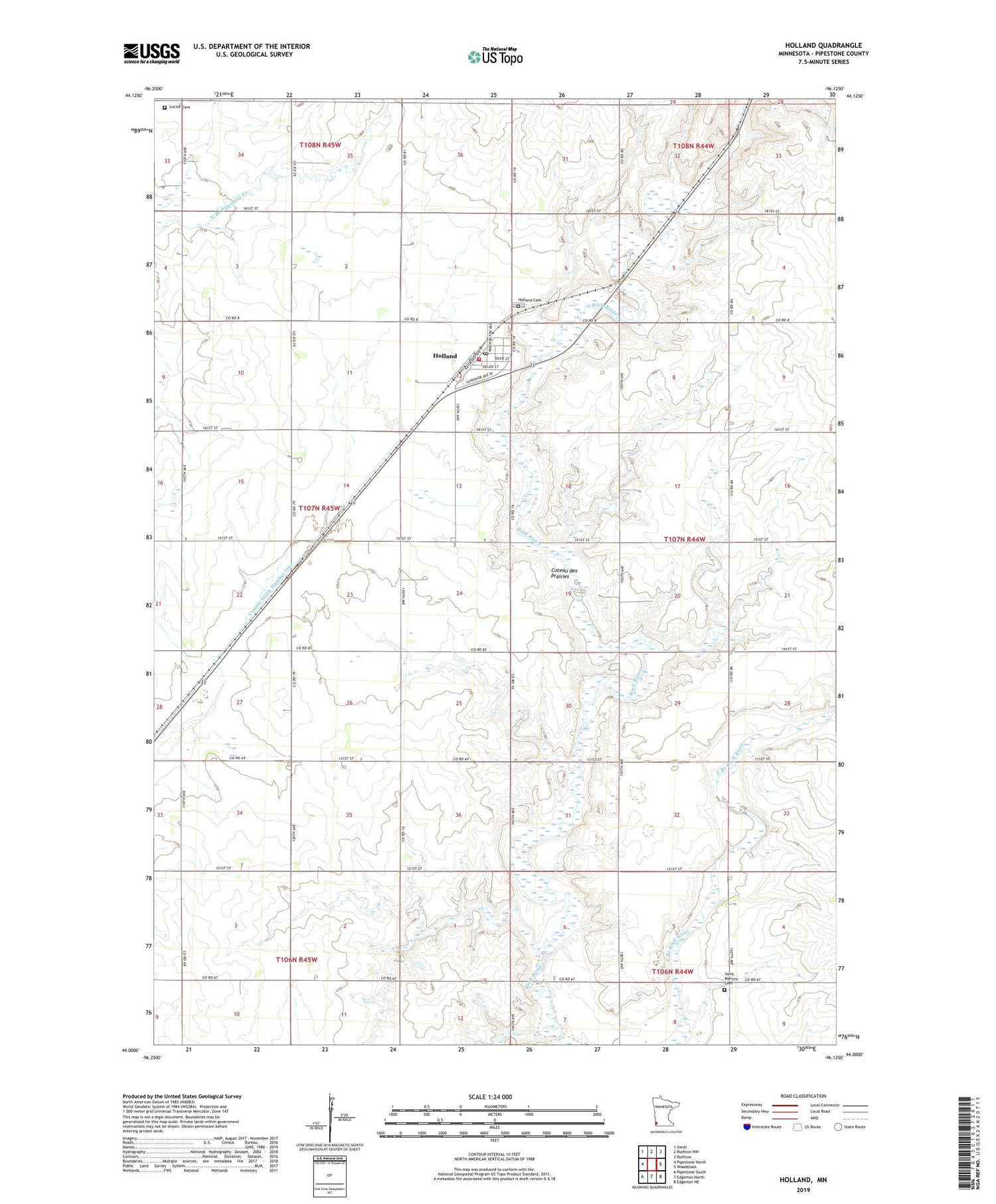
2019 topographic map quadrangle Holland in the state of Minnesota. Scale: 1:24000. Based on the newly updated USGS 7.5' US Topo map series, this map is in the following counties: Pipestone. The map contains contour data, water features, and other items you are used to seeing on USGS maps, but also has updated roads and other features. This is the next generation of topographic maps. Printed on high-quality waterproof paper with UV fade-resistant inks.
Quads adjacent to this one:
West: Pipestone North
Northwest: Verdi
North: Ruthton NW
Northeast: Ruthton
East: Woodstock
Southeast: Edgerton NE
South: Edgerton North
Southwest: Pipestone South
Contains the following named places: Brinkmeyer Farms, Christian Reformed Church, City of Holland, County Ditch Number One, Holland, Holland Cemetery, Holland Fire Department, Holland Post Office, Holland State Wildlife Management Area, Holland Wastewater Treatment Plant, Luctor Cemetery, Pheasant Terrace State Wildlife Management A, Pipestone County Gravel Pit, Rock River Ranch, Saint James Lutheran Church, Saint Martins Cemetery, Township of Grange, United Presbyterian Church, ZIP Code: 56139


