MyTopo
Ruthton Minnesota US Topo Map
Couldn't load pickup availability
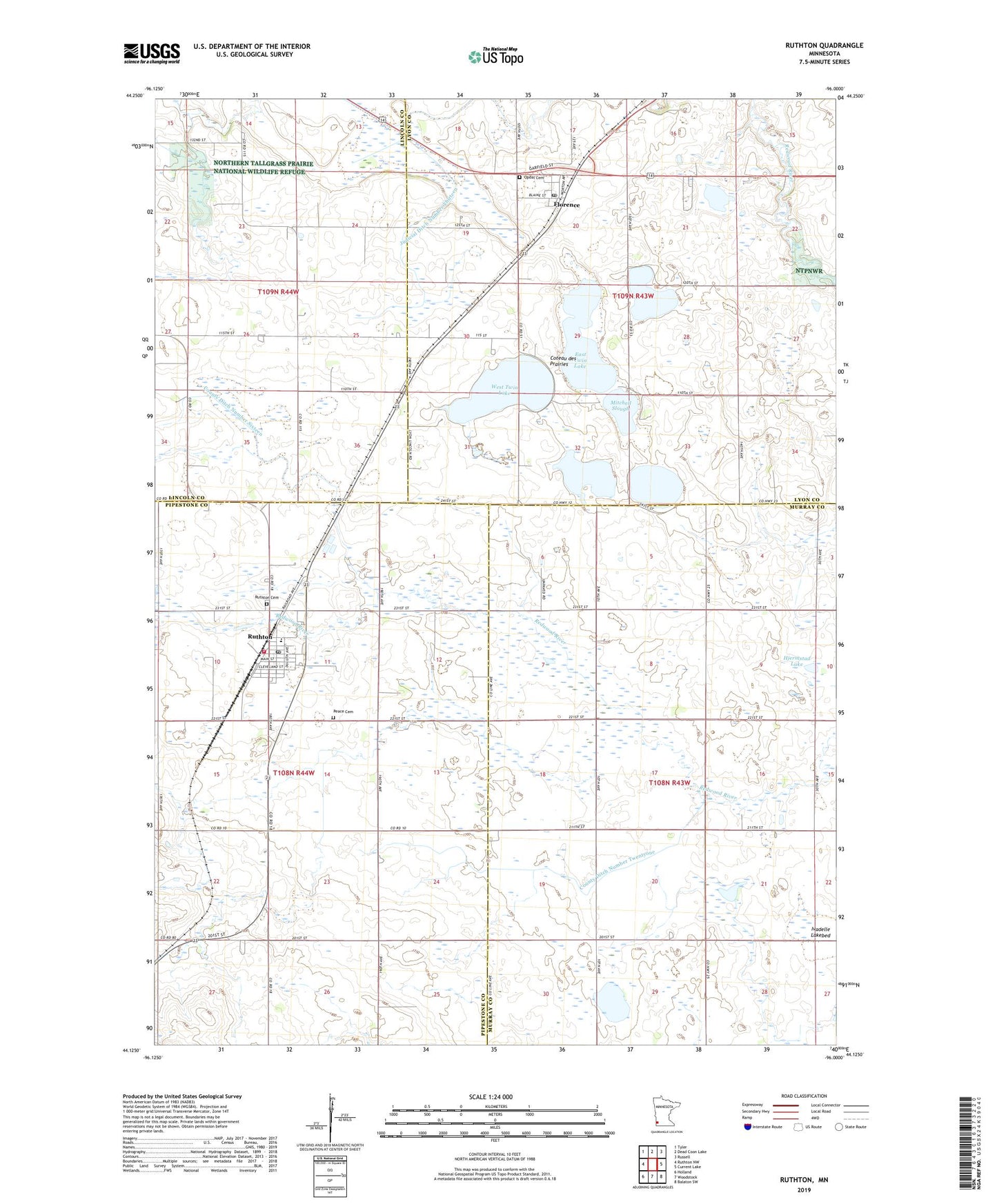
2022 topographic map quadrangle Ruthton in the state of Minnesota. Scale: 1:24000. Based on the newly updated USGS 7.5' US Topo map series, this map is in the following counties: Murray, Pipestone, Lyon, Lincoln. The map contains contour data, water features, and other items you are used to seeing on USGS maps, but also has updated roads and other features. This is the next generation of topographic maps. Printed on high-quality waterproof paper with UV fade-resistant inks.
Quads adjacent to this one:
West: Ruthton NW
Northwest: Tyler
North: Dead Coon Lake
Northeast: Russell
East: Current Lake
Southeast: Balaton SW
South: Woodstock
Southwest: Holland
This map covers the same area as the classic USGS quad with code o44096b1.
Contains the following named places: City of Florence, City of Ruthton, Country Church, County Ditch Number Sixteen, County Ditch Number Twentyone, East Twin Lake, Florence, Florence Post Office, Hjermstad Lake, Hjermstad Lake State Wildlife Management Are, Hope State Wildlife Management Area, Ivadelle Lakebed, Judicial Ditch Number Thirteen, Judicial Ditch Number Twelve, Lange State Wildlife Management Area, Mitchell Slough, Nyroca Flats State Wildlife Management Area, Opdal Cemetery, Peace Cemetery, Peace Lutheran Church, RTR Elementary School, Ruthton, Ruthton Cemetery, Ruthton Fire Department, Ruthton Post Office, Ruthton State Wildlife Management Area, Ruthton United Methodist Church, Township of Aetna, Township of Ellsborough, Township of Shelburne, Van Eck State Wildlife Management Area, West Twin Lake, ZIP Code: 56170