MyTopo
Hungry Jack Lake Minnesota US Topo Map
Couldn't load pickup availability
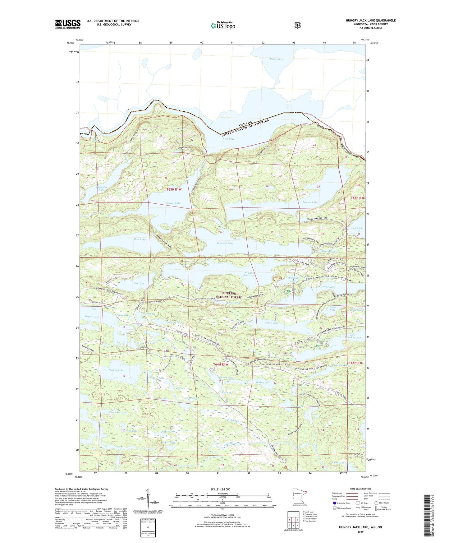
2019 topographic map quadrangle Hungry Jack Lake in the state of Minnesota. Scale: 1:24000. Based on the newly updated USGS 7.5' US Topo map series, this map is in the following counties: Cook. The map contains contour data, water features, and other items you are used to seeing on USGS maps, but also has updated roads and other features. This is the next generation of topographic maps. Printed on high-quality waterproof paper with UV fade-resistant inks.
Quads adjacent to this one:
West: South Lake
East: Crocodile Lake
Southeast: Pine Mountain
South: Lima Mountain
Southwest: Eagle Mountain
Contains the following named places: Aspen Lake, Bear Cub Lake, Bearskin Lake, Bearskin Lookout Tower, Bearskin-Hungry Jack Landing-Parking Access, Bogenho Lake, Bow Lake, Daniels Lake, Dot Lake, Duncan Lake, East Bearskin Campground, Fag Lake, Flour Lake, Flour Lake Campground, Glenn Lake, Gore Lake, Gunflint Trail Volunteer Fire Department Station 1, Honeymoon Bluff Trail and Overlook, Hooker Lake, Horseshoe Lake, Hungry Jack Lake, Hungry Jack Lodge and Campground, Lace Lake, Lake Helen, Lake Marie, Leo Lake, Locket Lake, Long Portage, Moss Lake, Nighthawk Lake, Okontoe Family Campsites, Partridge Lake, Pewee Lake, Poplar Creek, Prop Lake, Quiver Lake, Road Lake, Ruby Lake, Rudy Lake, Shoko Lake, Spen Lake, Squint Lake, Stairway Portage, Swamp Lake, Wampus Lake