MyTopo
Eagle Mountain Minnesota US Topo Map
Couldn't load pickup availability
Also explore the Eagle Mountain Forest Service Topo of this same quad for updated USFS data
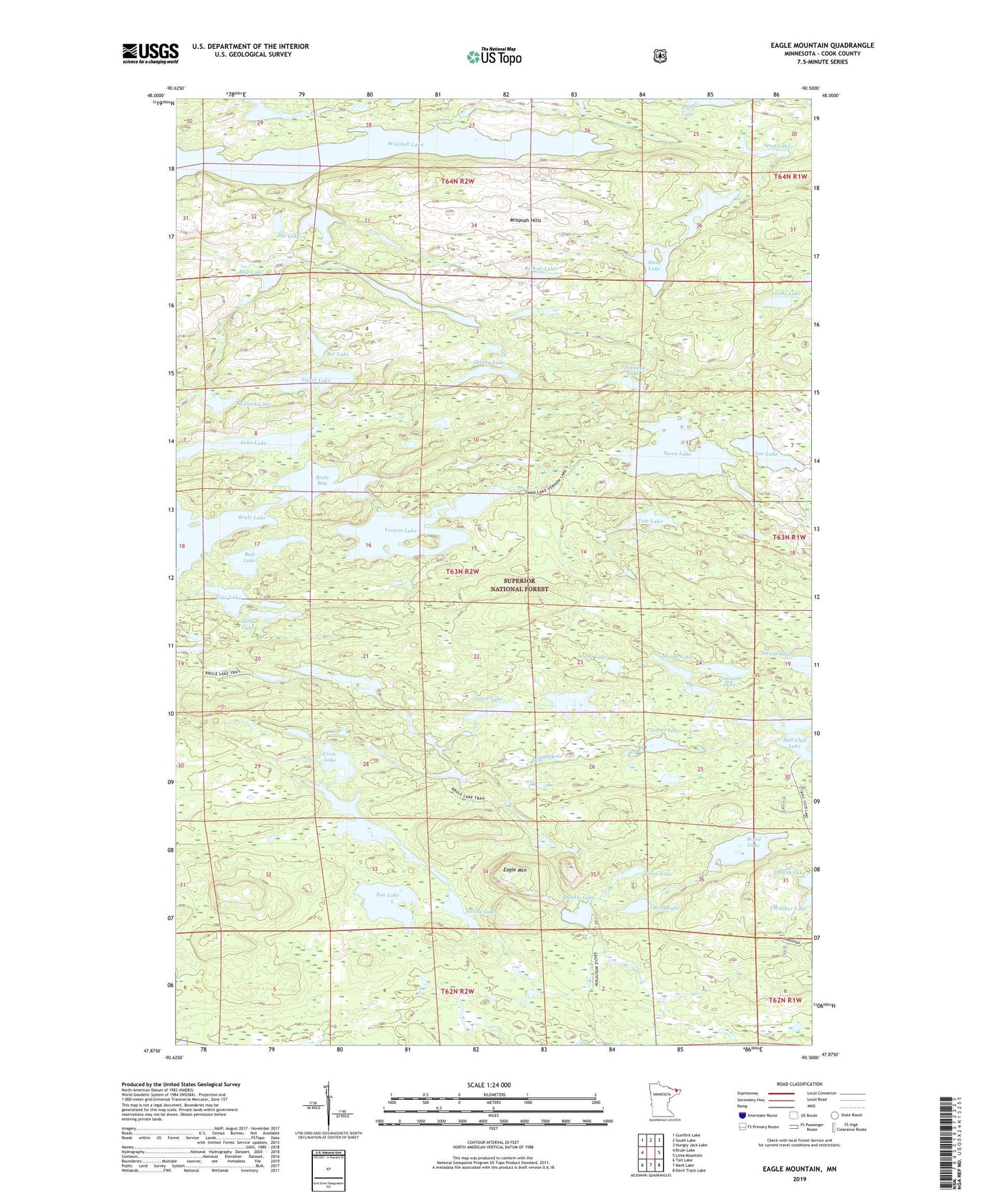
2022 topographic map quadrangle Eagle Mountain in the state of Minnesota. Scale: 1:24000. Based on the newly updated USGS 7.5' US Topo map series, this map is in the following counties: Cook. The map contains contour data, water features, and other items you are used to seeing on USGS maps, but also has updated roads and other features. This is the next generation of topographic maps. Printed on high-quality waterproof paper with UV fade-resistant inks.
Quads adjacent to this one:
West: Brule Lake
Northwest: Gunflint Lake
North: South Lake
Northeast: Hungry Jack Lake
East: Lima Mountain
Southeast: Devil Track Lake
South: Mark Lake
Southwest: Tait Lake
This map covers the same area as the classic USGS quad with code o47090h5.
Contains the following named places: Arena Lake, Ball Club Creek, Bannick Lake, Belly Lake, Bet Lake, Brule Bay, Bull Lake, Bunga Lake, Calf Lake, Cleaver Lake, Cow Lake, Crow Lake, Eagle Lake, Eagle Mountain, Echo Lake, Fishhook Lake, Footsteps Lake, Globe Lake, Goose Lake, Hand Creek, Hand Lake, Icicle Lake, Lac Lake, Ott Lake, Ozada Lake, Redeye Lake, Rug Lake, Shrike Lake, Skinny Lake, Spud Lake, State Lake, Swan Lake, Swede Lake, Tote Lake, Tremble Lake, Trine Lake, Tunmore Lake, Vance Lake, Vernon Lake, Vireo Lake, Whale Lake, Whitaker Lake, Winchell Lake, Zoo Lake, ZIP Code: 55604