MyTopo
Isle Minnesota US Topo Map
Couldn't load pickup availability
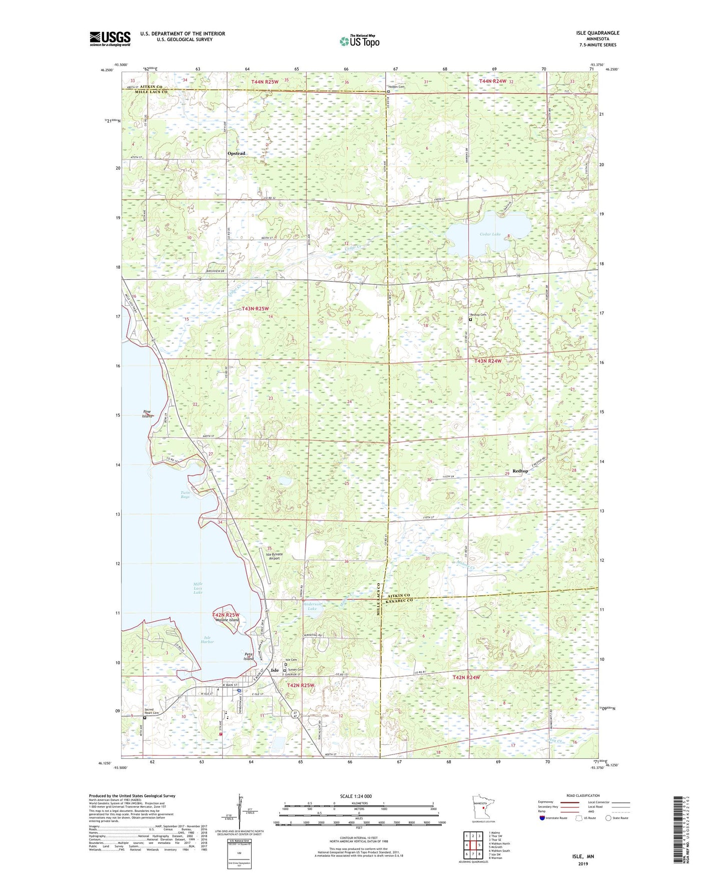
2019 topographic map quadrangle Isle in the state of Minnesota. Scale: 1:24000. Based on the newly updated USGS 7.5' US Topo map series, this map is in the following counties: Mille Lacs, Aitkin, Kanabec. The map contains contour data, water features, and other items you are used to seeing on USGS maps, but also has updated roads and other features. This is the next generation of topographic maps. Printed on high-quality waterproof paper with UV fade-resistant inks.
Quads adjacent to this one:
West: Wahkon North
Northwest: Malmo
North: Thor SW
Northeast: Thor SE
East: McGrath
Southeast: Warman
South: Isle SW
Southwest: Wahkon South
Contains the following named places: Anderson Lake, Cedar Creek, Cedar Lake, City of Isle, Faith Lutheran Cemetery, Father Hennepin State Park, Holden Cemetery, Holden Church, Isle, Isle Airport, Isle Cemetery, Isle Fire and Rescue Department, Isle Harbor, Isle Police Department, Isle Post Office, Malone Creek, Malone Island, Mille Lacs School, Opstead, Opstead Church, Pete Island, Pine Island, Redtop, Redtop Cemetery, Redtop Post Office, Sacred Heart Cemetery, Township of East Side, Twin Bays