MyTopo
Isle SW Minnesota US Topo Map
Couldn't load pickup availability
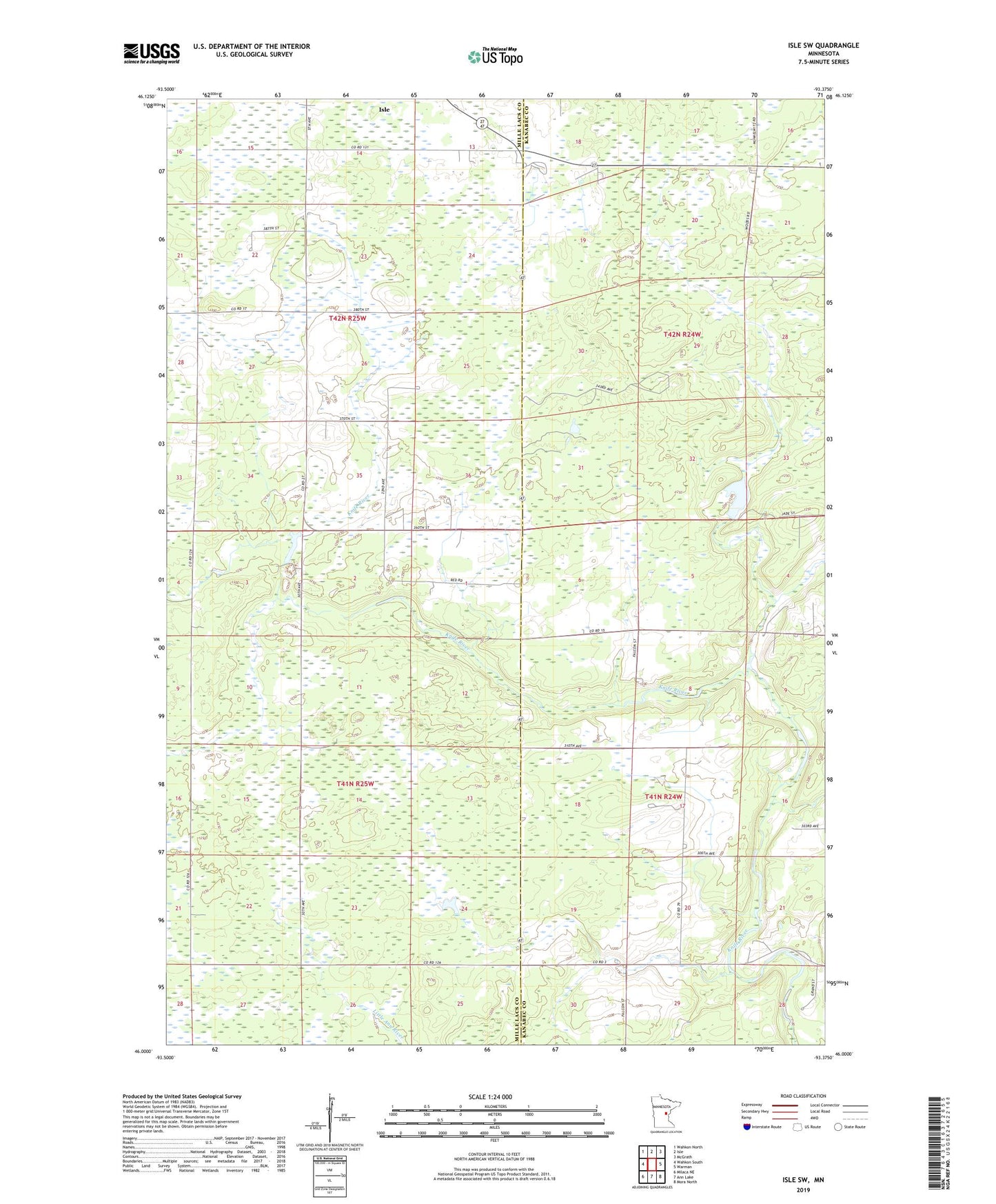
2022 topographic map quadrangle Isle SW in the state of Minnesota. Scale: 1:24000. Based on the newly updated USGS 7.5' US Topo map series, this map is in the following counties: Mille Lacs, Kanabec. The map contains contour data, water features, and other items you are used to seeing on USGS maps, but also has updated roads and other features. This is the next generation of topographic maps. Printed on high-quality waterproof paper with UV fade-resistant inks.
Quads adjacent to this one:
West: Wahkon South
Northwest: Wahkon North
North: Isle
Northeast: McGrath
East: Warman
Southeast: Mora North
South: Ann Lake
Southwest: Milaca NE
This map covers the same area as the classic USGS quad with code o46093a4.
Contains the following named places: Bergstedt Dam, Ernst Pool Dam, Isle Harbor Lookout Tower, Louis Richards Reservoir, Richards Pond Dam, Township of Isle Harbor, Township of Lewis