MyTopo
Wahkon South Minnesota US Topo Map
Couldn't load pickup availability
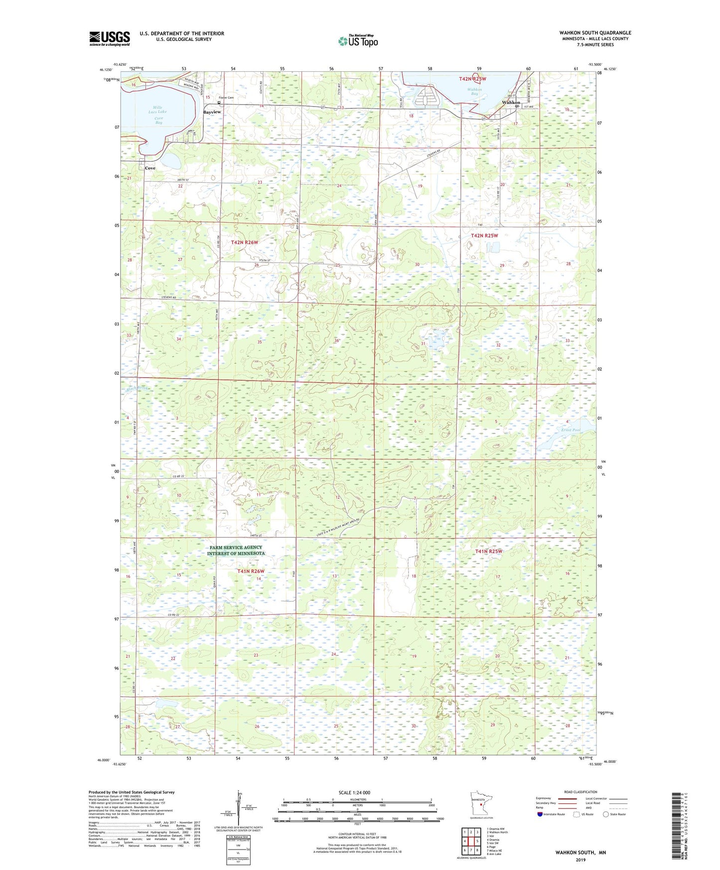
2022 topographic map quadrangle Wahkon South in the state of Minnesota. Scale: 1:24000. Based on the newly updated USGS 7.5' US Topo map series, this map is in the following counties: Mille Lacs. The map contains contour data, water features, and other items you are used to seeing on USGS maps, but also has updated roads and other features. This is the next generation of topographic maps. Printed on high-quality waterproof paper with UV fade-resistant inks.
Quads adjacent to this one:
West: Onamia
Northwest: Onamia NW
North: Wahkon North
Northeast: Isle
East: Isle SW
Southeast: Ann Lake
South: Milaca NE
Southwest: Page
This map covers the same area as the classic USGS quad with code o46093a5.
Contains the following named places: Bayview, Camp Johnson School, City of Wahkon, Cove, Cove Bay, Ernst Pool, Foster Cemetery, Korsness Pool, Korsness Pool Dam, Mulybys Island, Township of Onamia, Wahkon, Wahkon Post Office, ZIP Code: 56386