MyTopo
Kerrick Minnesota US Topo Map
Couldn't load pickup availability
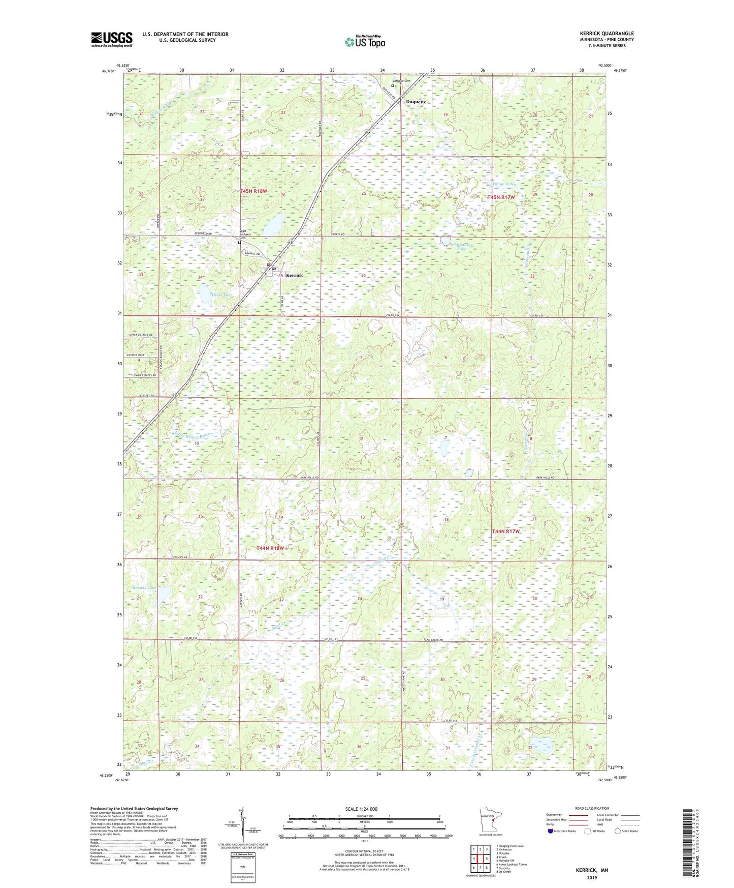
2022 topographic map quadrangle Kerrick in the state of Minnesota. Scale: 1:24000. Based on the newly updated USGS 7.5' US Topo map series, this map is in the following counties: Pine. The map contains contour data, water features, and other items you are used to seeing on USGS maps, but also has updated roads and other features. This is the next generation of topographic maps. Printed on high-quality waterproof paper with UV fade-resistant inks.
Quads adjacent to this one:
West: Bruno
Northwest: Hanging Horn Lake
North: Nickerson
Northeast: Holyoke
East: Holyoke SW
Southeast: Ox Creek
South: Duxbury
Southwest: Askov Lookout Tower
This map covers the same area as the classic USGS quad with code o46092c5.
Contains the following named places: Anderson-Berger Park and Campground, Bartels Lake, Catholic Cemetery, City of Kerrick, Duquette, Hicks Lake, Jackie Berger Memorial Park, Kerrick, Kerrick Fire and Rescue, Kerrick Post Office, Lake Margaret, Larsons Creek, Saint Michaels Cemetery, Township of Bruno, Walthausen Lake, ZIP Codes: 55712, 55756