MyTopo
Kettle Falls Minnesota US Topo Map
Couldn't load pickup availability
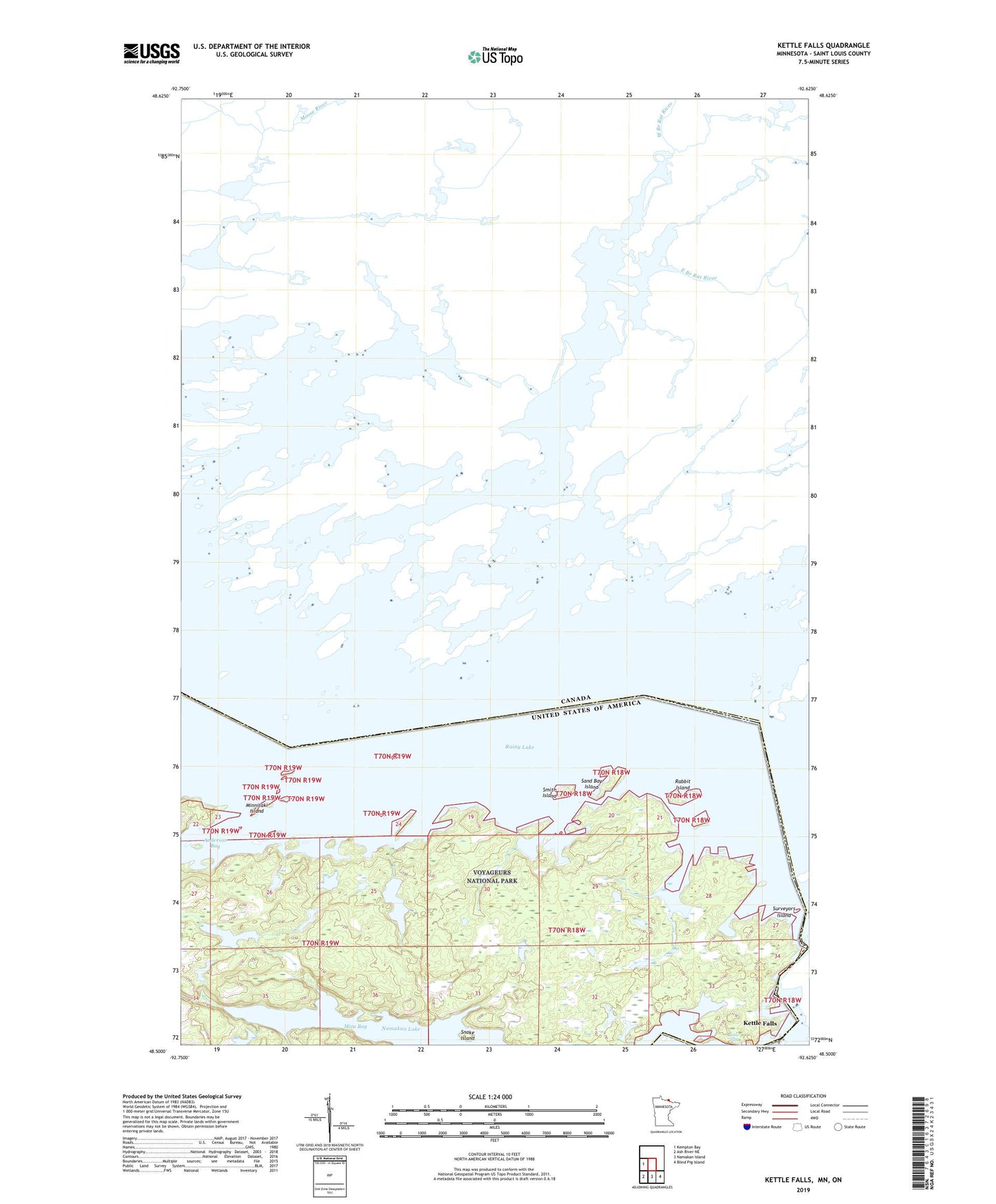
2022 topographic map quadrangle Kettle Falls in the state of Minnesota. Scale: 1:24000. Based on the newly updated USGS 7.5' US Topo map series, this map is in the following counties: St. Louis. The map contains contour data, water features, and other items you are used to seeing on USGS maps, but also has updated roads and other features. This is the next generation of topographic maps. Printed on high-quality waterproof paper with UV fade-resistant inks.
Quads adjacent to this one:
West: Kempton Bay
Southeast: Blind Pig Island
South: Namakan Island
Southwest: Ash River NE
This map covers the same area as the classic USGS quad with code o48092e6.
Contains the following named places: Anderson Bay, Kettle Falls, Kettle Falls Post Office, McDivitt Lake, Mica Bay, Minnitaki Island, Rabbit Island, Ryan Lake, Sand Bay Island, Smith Island, Snake Island, Surveyors Island