MyTopo
Lake Franklin Minnesota US Topo Map
Couldn't load pickup availability
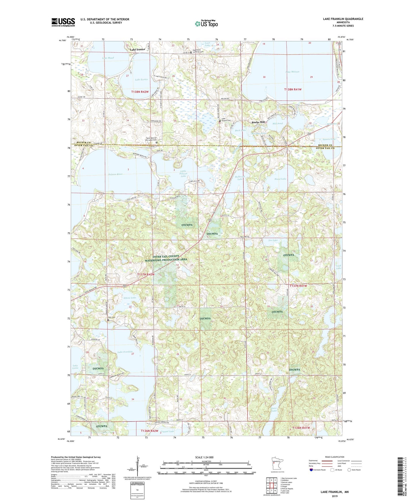
2019 topographic map quadrangle Lake Franklin in the state of Minnesota. Scale: 1:24000. Based on the newly updated USGS 7.5' US Topo map series, this map is in the following counties: Otter Tail, Becker. The map contains contour data, water features, and other items you are used to seeing on USGS maps, but also has updated roads and other features. This is the next generation of topographic maps. Printed on high-quality waterproof paper with UV fade-resistant inks.
Quads adjacent to this one:
West: Cormorant
Northwest: Big Cormorant Lake
North: Audubon
Northeast: Detroit Lakes
East: Vergas
Southeast: Star Lake
South: Lake Lida
Southwest: Pelican Rapids
Contains the following named places: Augustana Church, Augustana Lutheran Cemetery, Buck Lake, Bucks Mill, Bucks Mills Post Office, Elbow Lake, Eunice Lake, Eunice Lake Dam, Hand Lake, Holbrook Lake, Hook Lake, Lake Eunice, Lake Eunice Cemetery, Lake Eunice Post Office, Lake Franklin, Lake Maud, Lake Melissa, Little Pelican Lake, Meadow Lake Campsite, Mill Lake, Mill Pond, Minnow Pond, Otter Lake, Saint Mary of the Lakes Cemetery, Saint Mary of the Lakes Church, Sauers Lake, Sauers Lake Rest Area, Tee Lake, Township of Dunn, Wildflower at Fair Hills Golf Course, Windflower Golf Course, Zion Cemetery, Zion Church