MyTopo
Lakefield SW Minnesota US Topo Map
Couldn't load pickup availability
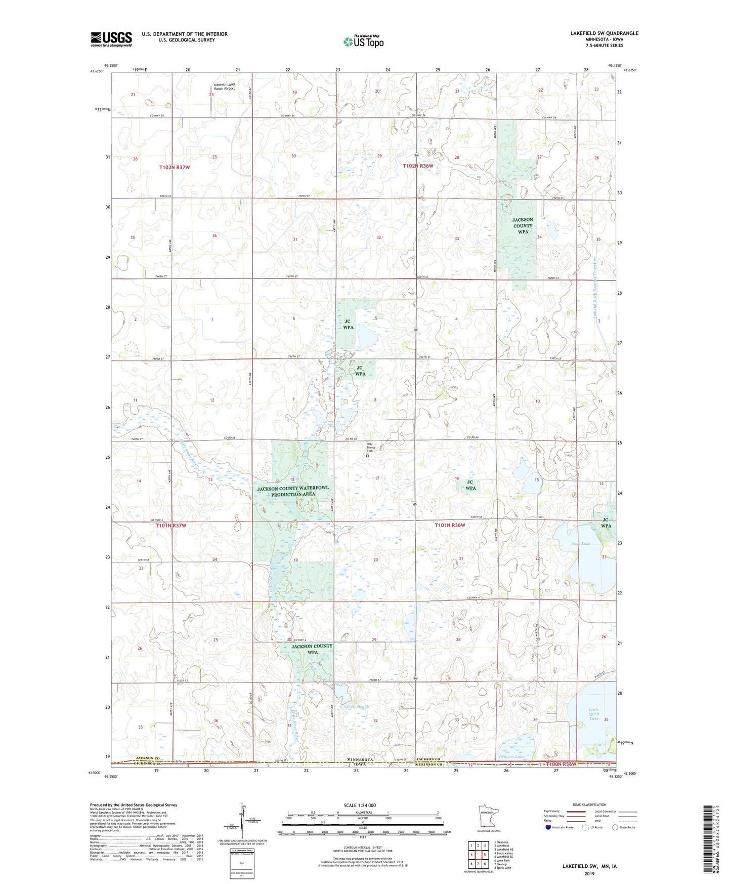
2022 topographic map quadrangle Lakefield SW in the states of Minnesota, Iowa. Scale: 1:24000. Based on the newly updated USGS 7.5' US Topo map series, this map is in the following counties: Jackson, Dickinson. The map contains contour data, water features, and other items you are used to seeing on USGS maps, but also has updated roads and other features. This is the next generation of topographic maps. Printed on high-quality waterproof paper with UV fade-resistant inks.
Quads adjacent to this one:
West: Sioux Valley
Northwest: Okabena
North: Lakefield
Northeast: Lakefield NE
East: Lakefield SE
Southeast: Spirit Lake
South: Okoboji
Southwest: Lake Park
This map covers the same area as the classic USGS quad with code o43095e2.
Contains the following named places: Grovers Lake, Holy Trinity Cemetery, Holy Trinity Church, Husen State Wildlife Management Area, Jackson County Waterfowl Production Area, Judicial Ditch Number Thirtyfive, Little Sioux State Wildlife Management Area, Little Spirit Lake, Minnesota Slough State Wildlife Management A, Nauerth Land Ranch Airport, Pavelko State Wildlife Management Area, Rush Lake, Saint Johns Church, Sangl State Wildlife Management Area, Sangls Slough, Township of Minneota