MyTopo
Lancaster Minnesota US Topo Map
Couldn't load pickup availability
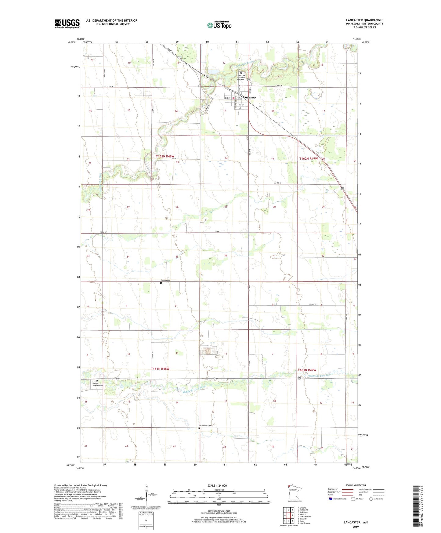
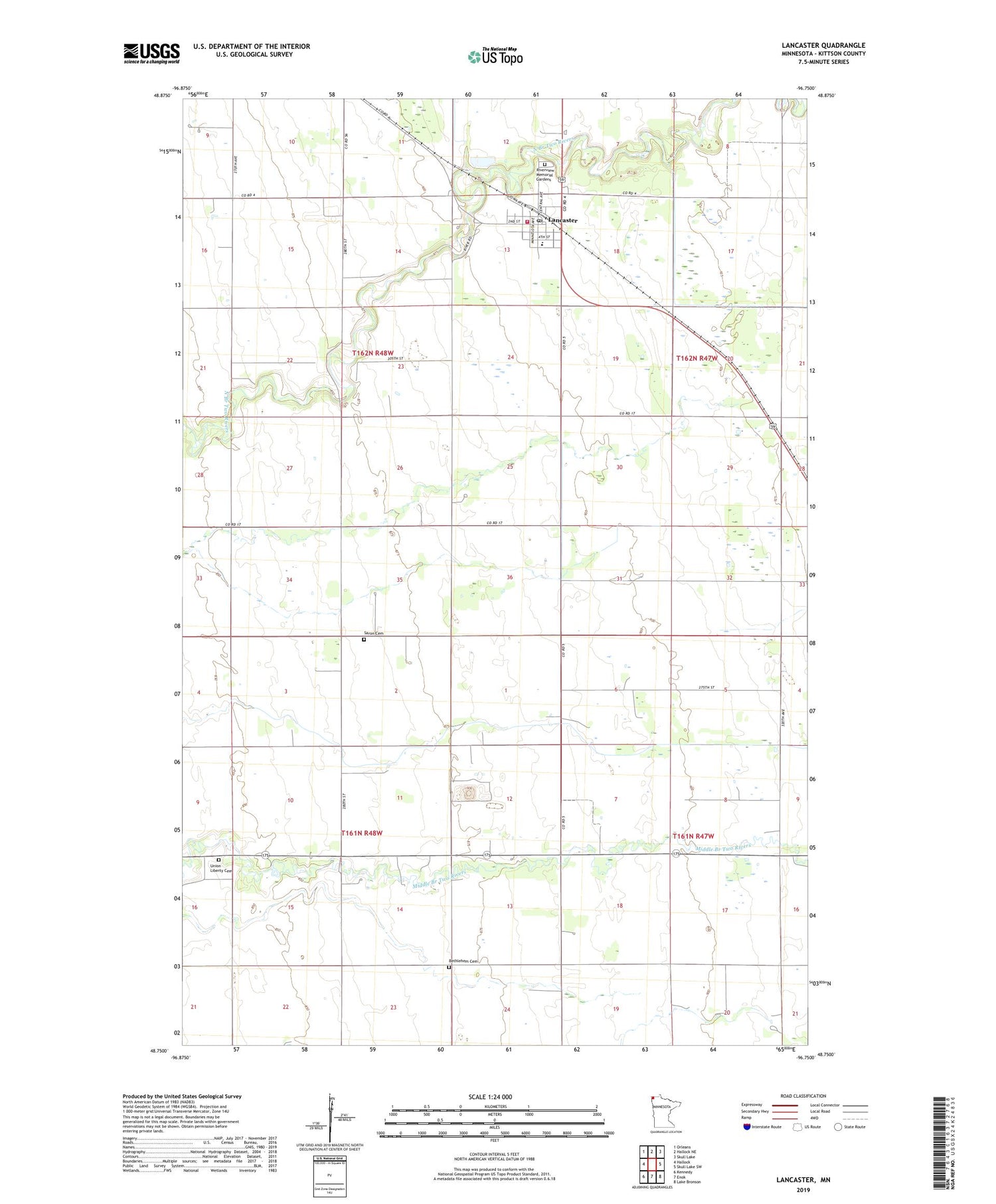
2019 topographic map quadrangle Lancaster in the state of Minnesota. Scale: 1:24000. Based on the newly updated USGS 7.5' US Topo map series, this map is in the following counties: Kittson. The map contains contour data, water features, and other items you are used to seeing on USGS maps, but also has updated roads and other features. This is the next generation of topographic maps. Printed on high-quality waterproof paper with UV fade-resistant inks.
Quads adjacent to this one:
West: Hallock
Northwest: Orleans
North: Hallock NE
Northeast: Skull Lake
East: Skull Lake SW
Southeast: Lake Bronson
South: Enok
Southwest: Kennedy
Contains the following named places: Bethlehem Cemetery, Bonish Post Office, City of Lancaster, East Granville School, Franklin School, Hazelton State Game Refuge, Judicial Ditch Number Eightyfour, Kittson County, Lancaster, Lancaster City Hall, Lancaster City Park Campground, Lancaster Covenant Church, Lancaster Fire Department, Lancaster Middle School, Lancaster Post Office, Lancaster Station, Nylander School, Riverside School, Riverview Memorial Gardens, Saron Cemetery, Township of Granville, Township of Thompson, Union Liberty Cemetery, Webster School, Zion Lutheran Church