
MyTopo
Little Bowstring Lake Minnesota US Topo Map
Couldn't load pickup availability
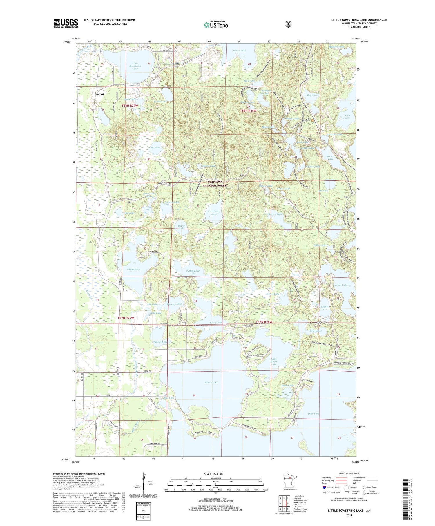
2019 topographic map quadrangle Little Bowstring Lake in the state of Minnesota. Scale: 1:24000. Based on the newly updated USGS 7.5' US Topo map series, this map is in the following counties: Itasca. The map contains contour data, water features, and other items you are used to seeing on USGS maps, but also has updated roads and other features. This is the next generation of topographic maps. Printed on high-quality waterproof paper with UV fade-resistant inks.
Quads adjacent to this one:
West: Deer River NE
Northwest: Jessie Lake
North: Marcell
Northeast: Clubhouse Lake
East: Wabana Lake
Southeast: Cohasset East
South: Cohasset West
Southwest: Deer River
Contains the following named places: Adele Lake, Alex Lake, Alp Lake, Amen Lake, Balloon Lake, Bay Lake, Beaver Lake, Big Green Lake, Big Horn Lake, Boiler Lake, Camp Five Lakes, Carpenter Lake, Clara Church, Cottonwood Lake, Cranberry Lake, Crane Lake, Dalton Lake, Day Lake, Day Lake Lookout Tower, Deer Lake, Deer Lake Dam, Doam Lake, Doctor Lake, Edd Lake, Fawn Lake, Forjer Lake, Grave Lake, Green Lake, Hanson Lake, Hooligan Lake, Island Lake, Island Lake Creek, Jim Lake, Kremer Lake, Lee Lake, Little Bowstring Lake, Little Cottonwood Lake, Little Horn Lake, Little Moose Lake, Maki Lake, McDonald Lake, Miller Lake, Moore Lake, Moose Lake, Mud Lake, Myers Lake, Mystery Lake, Otter Lake, Oxbow Lake, Pickerel Lake, Pothole Lake, Poverty Lake, Spruce Island Lake, Suomi, Suomi Church, Suomi Hills Recreation Area, Suomi Hills Trail System, Suomi Lake, Suomi Post Office, Surprise Lake, Surprise Lake Wayside Park, Township of Deer River


