MyTopo
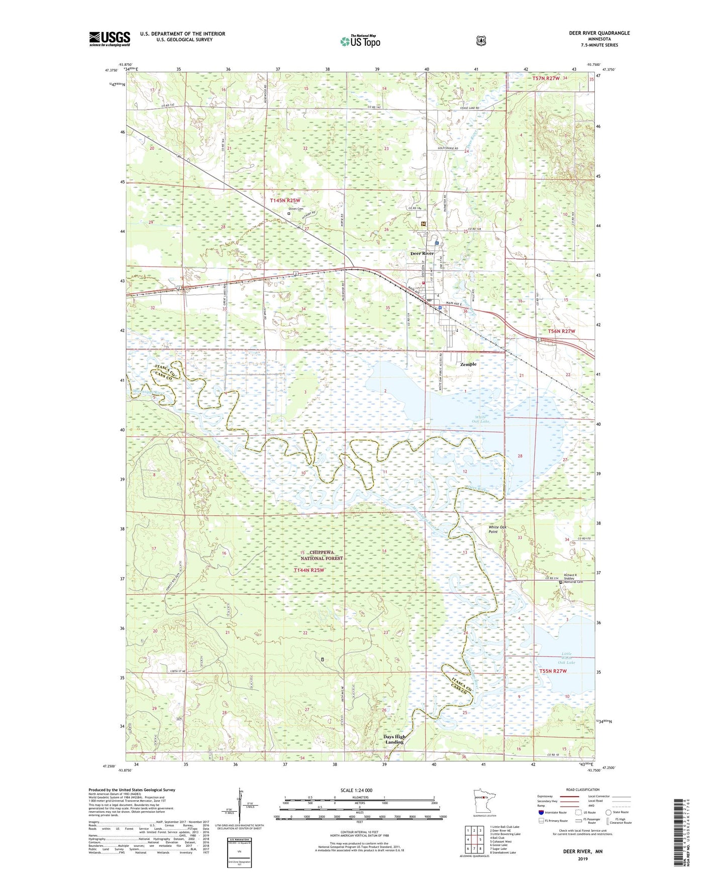
Deer River Minnesota US Topo Map
Couldn't load pickup availability
Also explore the Deer River Forest Service Topo of this same quad for updated USFS data
2022 topographic map quadrangle Deer River in the state of Minnesota. Scale: 1:24000. Based on the newly updated USGS 7.5' US Topo map series, this map is in the following counties: Itasca, Cass. The map contains contour data, water features, and other items you are used to seeing on USGS maps, but also has updated roads and other features. This is the next generation of topographic maps. Printed on high-quality waterproof paper with UV fade-resistant inks.
Quads adjacent to this one:
West: Ball Club
Northwest: Little Ball Club Lake
North: Deer River NE
Northeast: Little Bowstring Lake
East: Cohasset West
Southeast: Siseebakwet Lake
South: Sugar Lake
Southwest: Goose Lake
This map covers the same area as the classic USGS quad with code o47093c7.
Contains the following named places: Bethany Lutheran Church, Blueberry Hill Lookout Tower, Blueberry Hills Golf Course, City of Deer River, City of Zemple, Days High Landing, Deer River, Deer River Ambulance, Deer River Bible Church, Deer River Church of God, Deer River District Ranger Office, Deer River Fire Department, Deer River High School, Deer River Municipal Airport, Deer River Police Department, Deer River Post Office, Deer River Wayside Park, Duluth Clinic - Deer River, Essentia Health - Deer River, Evangelical Covenant Church, Homestead Nursing Home, King Elementary School, Liston Evergreen Mobile Home Park, Little White Oak Lake, Olivet Cemetery, Redeemer Lutheran Church, Richard R Shadley Memorial Cemetery, Saint Augustine Church, Saint Mary's Church, Township of Morse, Township of Wahnena, United Methodist Church, Unorganized Territory of Wahnena, White Oak Lake, White Oak Point, Zemple