MyTopo
Randall East Minnesota US Topo Map
Couldn't load pickup availability
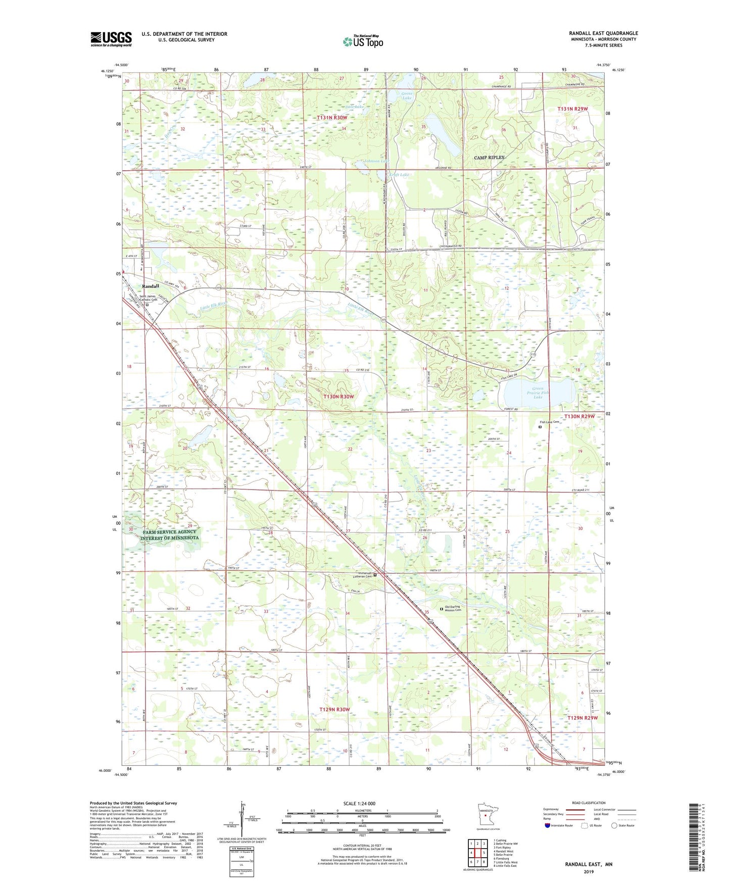
2022 topographic map quadrangle Randall East in the state of Minnesota. Scale: 1:24000. Based on the newly updated USGS 7.5' US Topo map series, this map is in the following counties: Morrison. The map contains contour data, water features, and other items you are used to seeing on USGS maps, but also has updated roads and other features. This is the next generation of topographic maps. Printed on high-quality waterproof paper with UV fade-resistant inks.
Quads adjacent to this one:
West: Randall West
Northwest: Cushing
North: Belle Prairie NW
Northeast: Fort Ripley
East: Belle Prairie
Southeast: Little Falls East
South: Little Falls West
Southwest: Flensburg
This map covers the same area as the classic USGS quad with code o46094a4.
Contains the following named places: Dale Lake, Darling Post Office, Darling Switch, Doctor S G Knight Elementary School, Ferrell Lake, Fish Lake Cemetery, Goose Lake, Green Prairie Fish Lake, Immanuel Church, Immanuel Lutheran Cemetery, Johnson Lake, Kraft Lake, Old Darling Mission Cemetery, Randall Fire Station, Saint James Catholic Cemetery, Saint James Catholic Church, School Number 33, School Number 35, School Number 37, School Number 57, School Number 74, South Branch Little Elk River, Thirty-Seven Acres Resort and Campground, Three Finger Lake, Township of Darling