MyTopo
Lyle Minnesota US Topo Map
Couldn't load pickup availability
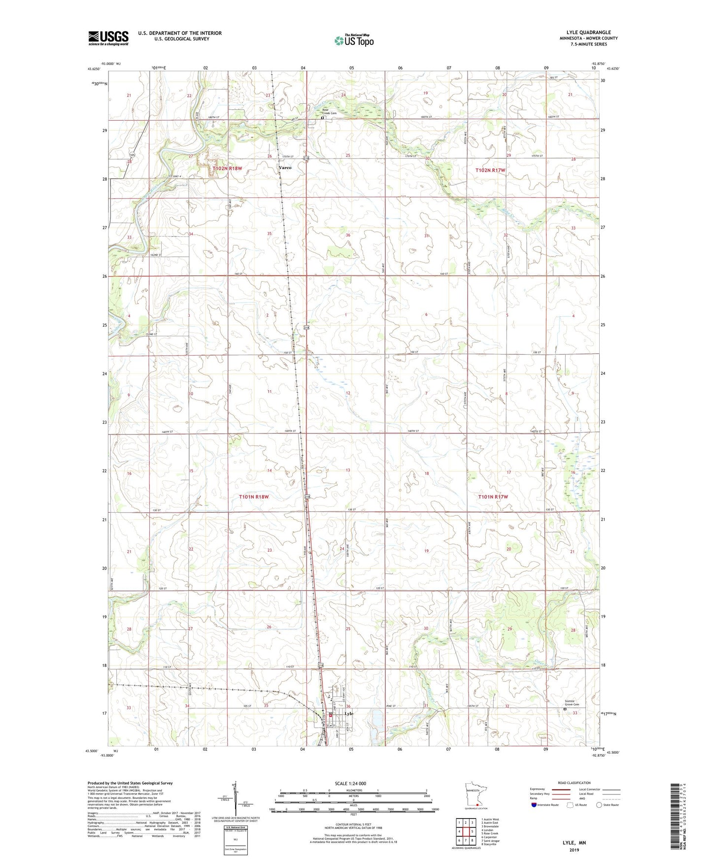
2019 topographic map quadrangle Lyle in the state of Minnesota. Scale: 1:24000. Based on the newly updated USGS 7.5' US Topo map series, this map is in the following counties: Mower. The map contains contour data, water features, and other items you are used to seeing on USGS maps, but also has updated roads and other features. This is the next generation of topographic maps. Printed on high-quality waterproof paper with UV fade-resistant inks.
Quads adjacent to this one:
West: London
Northwest: Austin West
North: Austin East
Northeast: Brownsdale
East: Rose Creek
Southeast: Stacyville
South: Saint Ansgar
Southwest: Carpenter
Contains the following named places: City of Lyle, Enterprise School, Excelsior School, Gregg School, Hawkins School, KAUS-AM (Austin), Larson State Wildlife Management Area, Lyle, Lyle Center School, Lyle City Hall, Lyle Community Library, Lyle Post Office, Lyle Secondary School, Lyle Volunteer Fire Department, Minnereka School, Our Saviour's Lutheran Church, Pinehurst School, Ransom Trailer Court, Red Star School, River Bend Campground, Rose Creek, Rose Creek Cemetery, Sixmile Grove Cemetery, Sixmile Grove Church, Township of Austin, Township of Lyle, Trinity Lutheran Church, Varco, Varco Post Office, ZIP Code: 55953