MyTopo
Stacyville Iowa US Topo Map
Couldn't load pickup availability
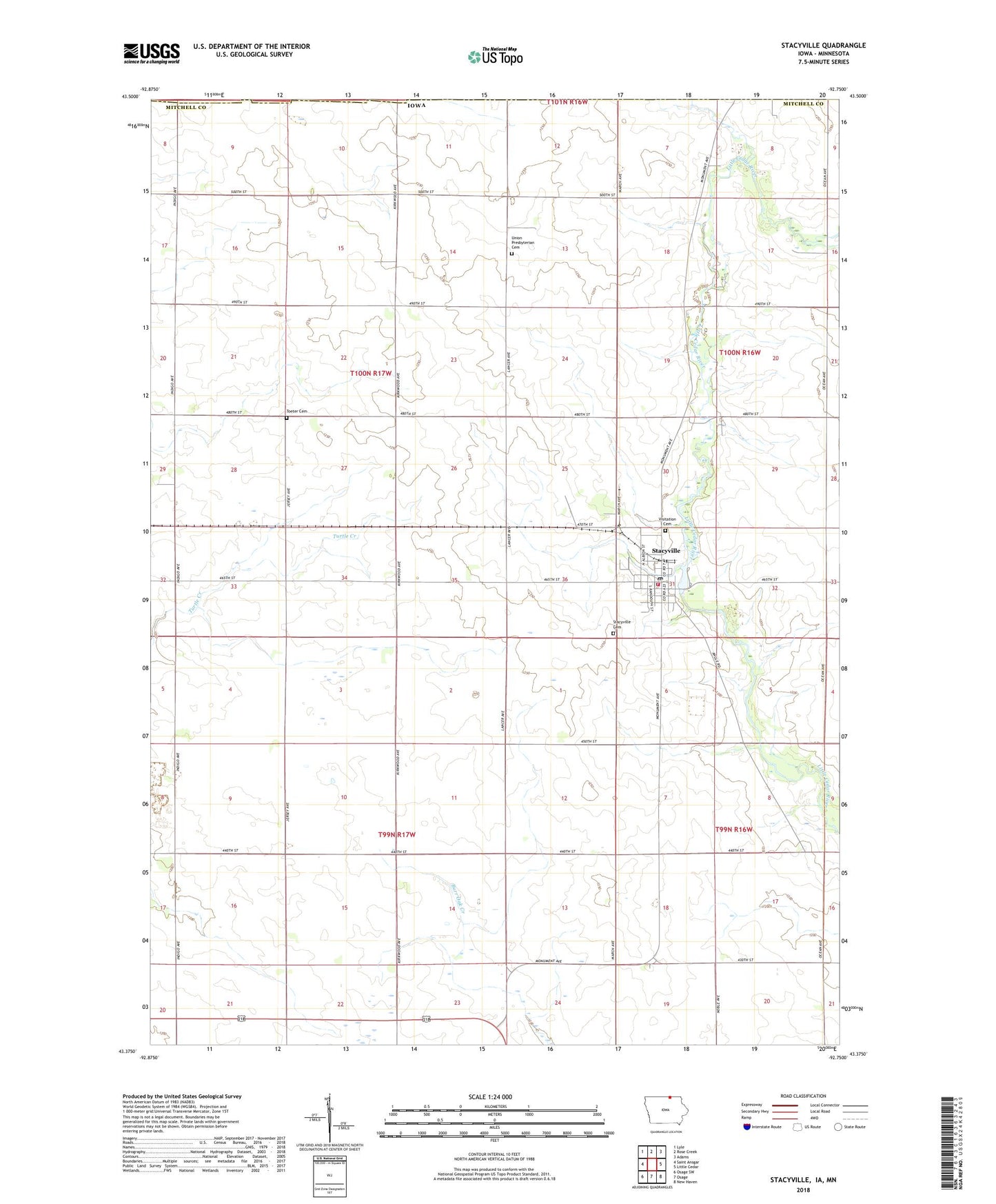
2022 topographic map quadrangle Stacyville in the state of Iowa. Scale: 1:24000. Based on the newly updated USGS 7.5' US Topo map series, this map is in the following counties: Mitchell, Mower. The map contains contour data, water features, and other items you are used to seeing on USGS maps, but also has updated roads and other features. This is the next generation of topographic maps. Printed on high-quality waterproof paper with UV fade-resistant inks.
Quads adjacent to this one:
West: Saint Ansgar
Northwest: Lyle
North: Rose Creek
Northeast: Adams
East: Little Cedar
Southeast: New Haven
South: Osage
Southwest: Osage SW
Contains the following named places: Brumm Dairy, City of Stacyville, Gerbigs Woods, Peavey Company Elevator, Riverside Park, Stacyville, Stacyville Cemetery, Stacyville Community Nursing Home, Stacyville Cooperative Company Elevator, Stacyville Fire Department, Stacyville Post Office, Stacyville Public Library, Toeter Cemetery, Township of Union, Union Church, Union Presbyterian Cemetery, Visitation Cemetery, Visitation Church, Visitation Elementary School, ZIP Code: 50476