MyTopo
Magnolia Minnesota US Topo Map
Couldn't load pickup availability
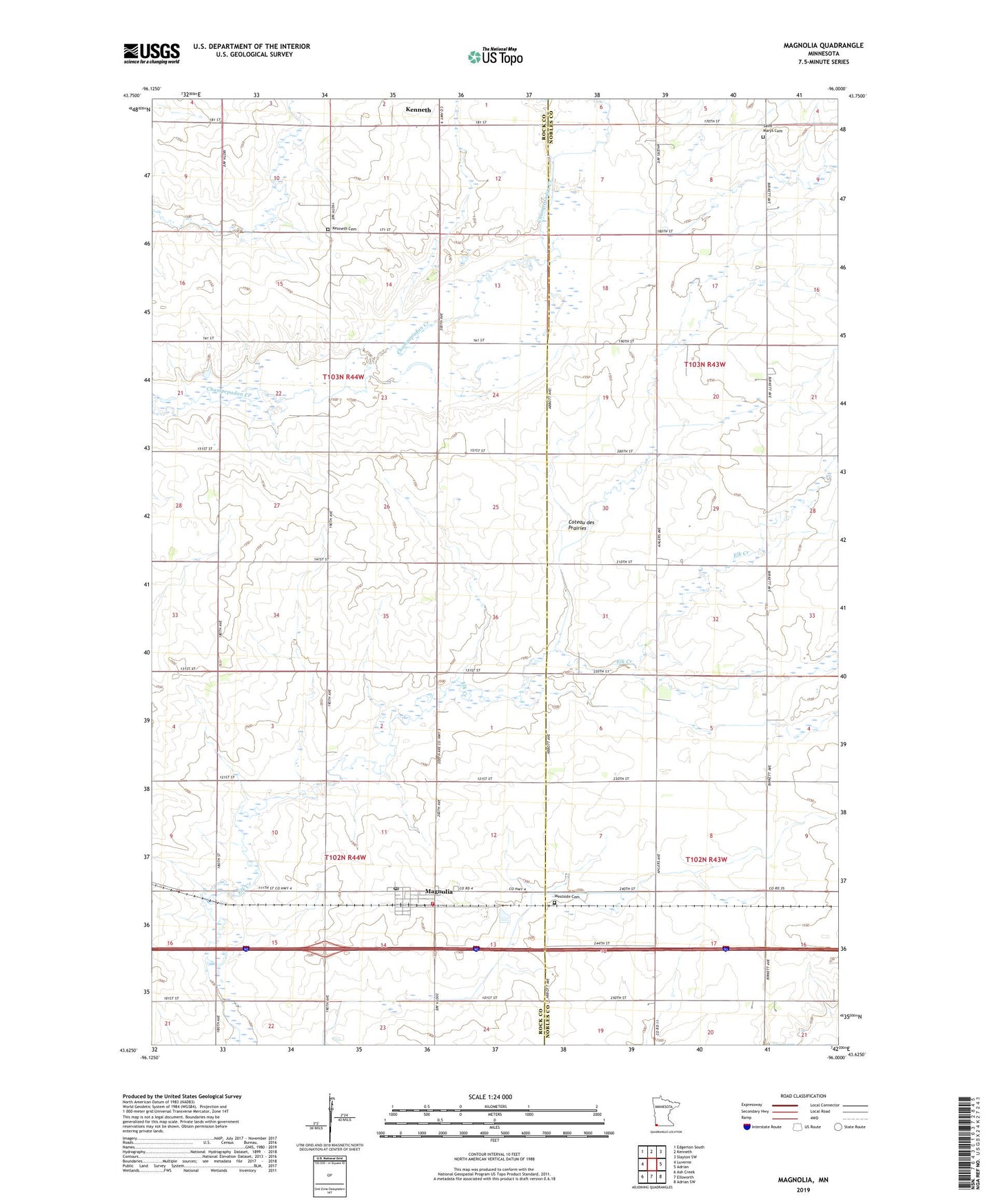
2019 topographic map quadrangle Magnolia in the state of Minnesota. Scale: 1:24000. Based on the newly updated USGS 7.5' US Topo map series, this map is in the following counties: Rock, Nobles. The map contains contour data, water features, and other items you are used to seeing on USGS maps, but also has updated roads and other features. This is the next generation of topographic maps. Printed on high-quality waterproof paper with UV fade-resistant inks.
Quads adjacent to this one:
West: Luverne
Northwest: Edgerton South
North: Kenneth
Northeast: Slayton SW
East: Adrian
Southeast: Adrian SW
South: Ellsworth
Southwest: Ash Creek
Contains the following named places: City of Magnolia, Kenneth Cemetery, Knips Hog Farms, Magnolia, Magnolia Post Office, Magnolia United Methodist Church, Magnolia Volunteer Fire Department, Saint Marys Cemetery, School Number 669, Township of Magnolia, Township of Vienna, Westside Cemetery, ZIP Code: 56158