MyTopo
Malung Minnesota US Topo Map
Couldn't load pickup availability
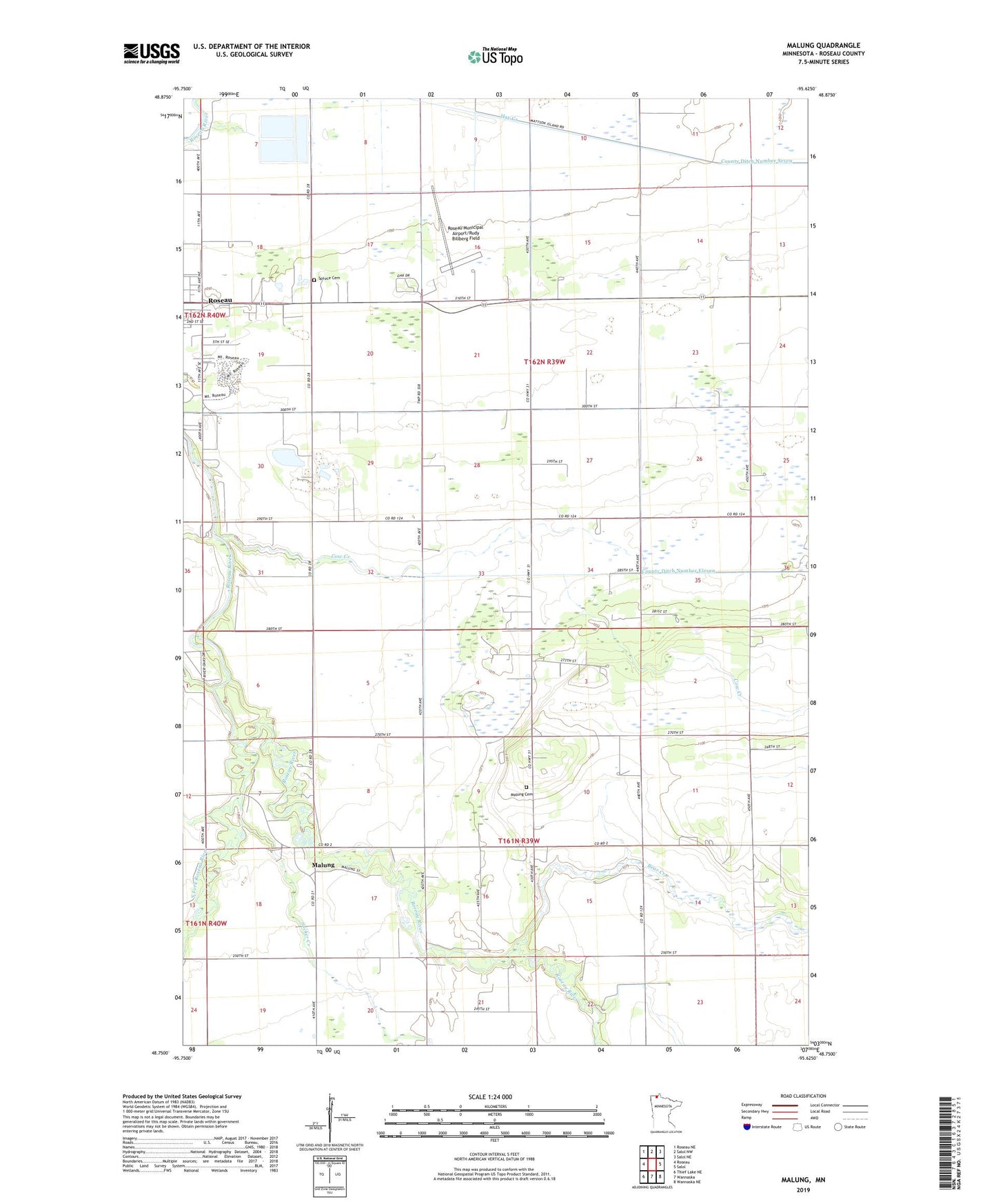
2022 topographic map quadrangle Malung in the state of Minnesota. Scale: 1:24000. Based on the newly updated USGS 7.5' US Topo map series, this map is in the following counties: Roseau. The map contains contour data, water features, and other items you are used to seeing on USGS maps, but also has updated roads and other features. This is the next generation of topographic maps. Printed on high-quality waterproof paper with UV fade-resistant inks.
Quads adjacent to this one:
West: Roseau
Northwest: Roseau NE
North: Salol NW
Northeast: Salol NE
East: Salol
Southeast: Wannaska NE
South: Wannaska
Southwest: Thief Lake NE
This map covers the same area as the classic USGS quad with code o48095g6.
Contains the following named places: Bear Creek, County Ditch Number Eleven, Cow Creek, First Baptist Church, KRWB-AM (Roseau), Malung, Malung Cemetery, Malung Elementary School, Malung Hall, Malung Post Office, Mandus Post Office, Mandus Station, Mobile Court East, Roseau Community Church, Roseau Municipal Airport/Rudy Billberg Field, South Fork Roseau River, Spruce Cemetery, Spruce Church, Sucker Creek, Township of Malung, Township of Spruce, ZIP Code: 56751