MyTopo
Marietta Minnesota US Topo Map
Couldn't load pickup availability
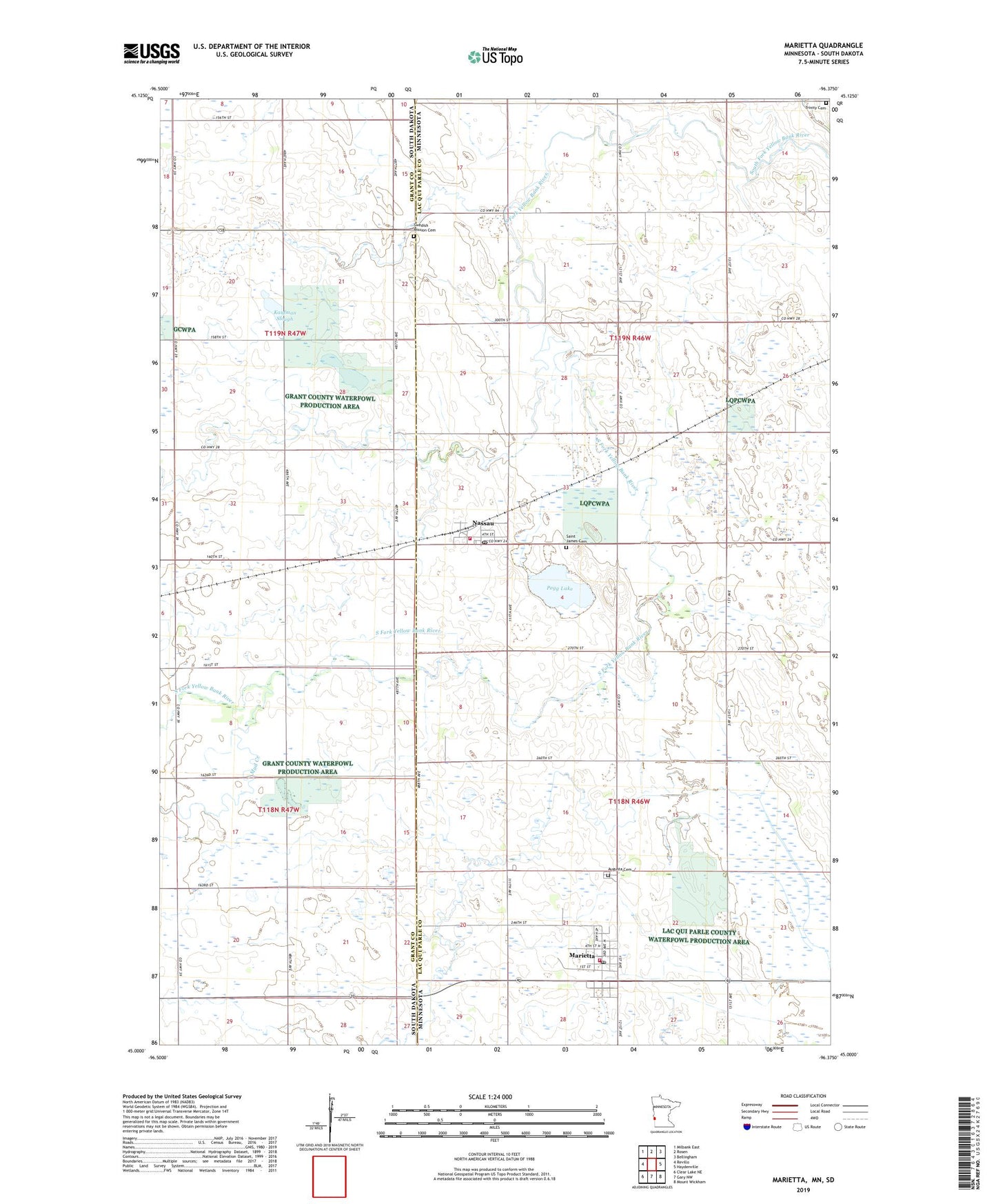
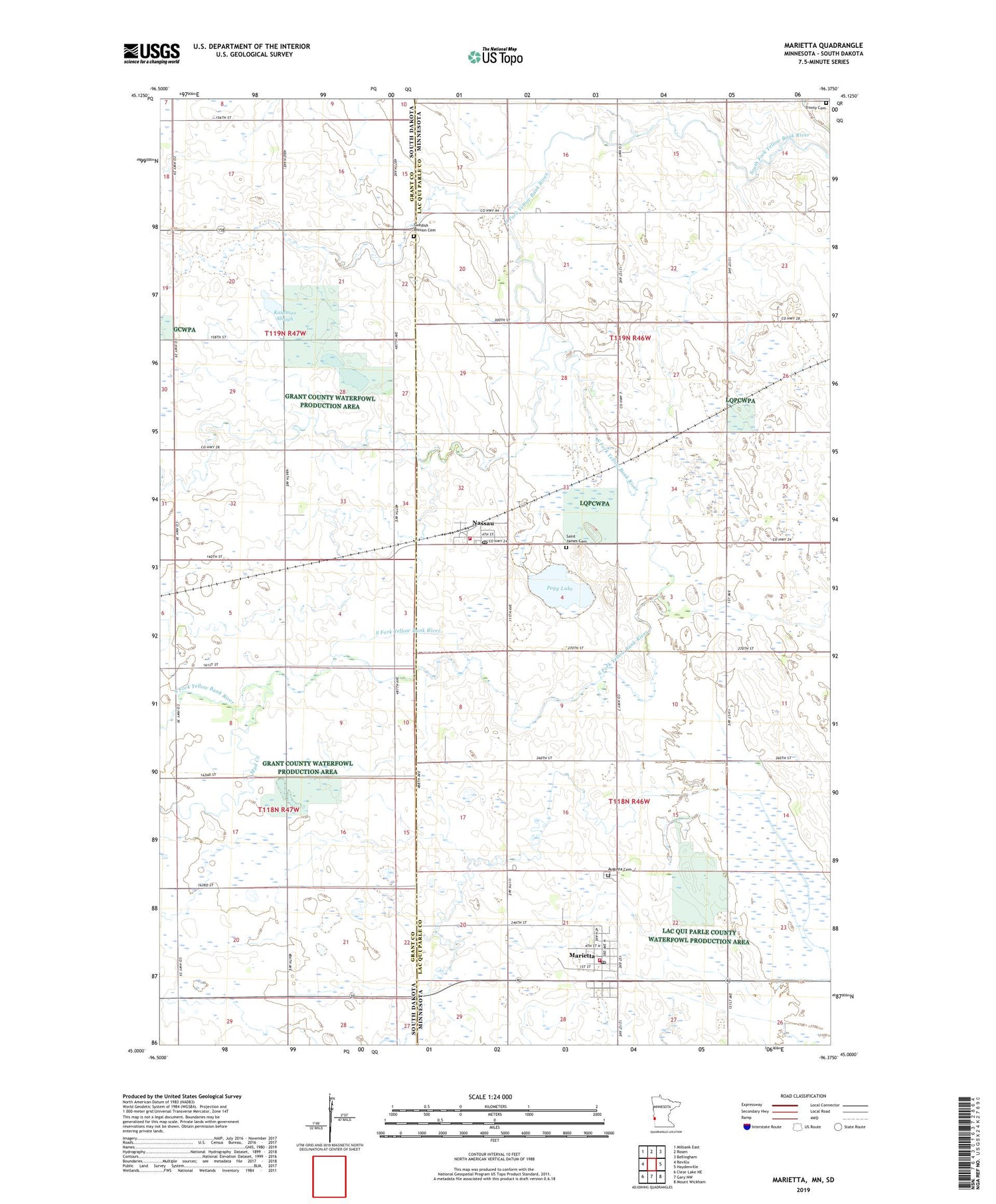
2019 topographic map quadrangle Marietta in the states of Minnesota, South Dakota. Scale: 1:24000. Based on the newly updated USGS 7.5' US Topo map series, this map is in the following counties: Lac qui Parle, Grant. The map contains contour data, water features, and other items you are used to seeing on USGS maps, but also has updated roads and other features. This is the next generation of topographic maps. Printed on high-quality waterproof paper with UV fade-resistant inks.
Quads adjacent to this one:
West: Revillo
Northwest: Milbank East
North: Rosen
Northeast: Bellingham
East: Haydenville
Southeast: Mount Wickham
South: Gary NW
Southwest: Clear Lake NE
Contains the following named places: Augusta Cemetery, Augustana Lutheran Church, City of Marietta, City of Nassau, Kaufman Slough, Marietta, Marietta Ambulance Service, Marietta Clinic, Marietta Fire Department, Marietta Post Office, Mud Creek, Nassau, Nassau Fire Department, Nassau Post Office, Pegg Lake, Saint James Catholic Church, Saint James Cemetery, Saint John's Lutheran Church, School Number 107, Swedish Mission Cemetery, Township of Augusta, Township of Walter, Trinity Cemetery, United Church of Christ