MyTopo
Rosen Minnesota US Topo Map
Couldn't load pickup availability
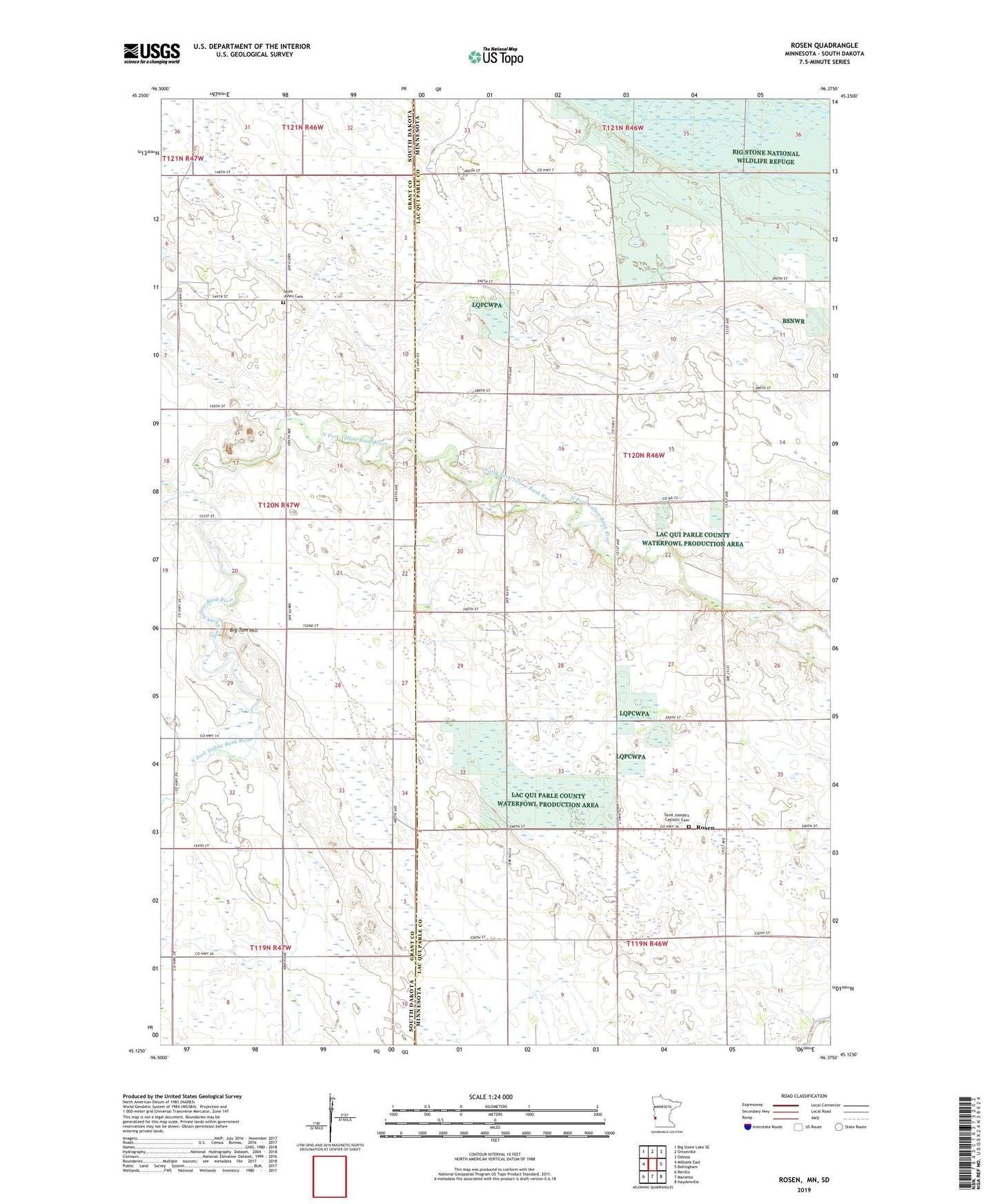
2022 topographic map quadrangle Rosen in the states of Minnesota, South Dakota. Scale: 1:24000. Based on the newly updated USGS 7.5' US Topo map series, this map is in the following counties: Lac qui Parle, Grant. The map contains contour data, water features, and other items you are used to seeing on USGS maps, but also has updated roads and other features. This is the next generation of topographic maps. Printed on high-quality waterproof paper with UV fade-resistant inks.
Quads adjacent to this one:
West: Milbank East
Northwest: Big Stone Lake SE
North: Ortonville
Northeast: Odessa
East: Bellingham
Southeast: Haydenville
South: Marietta
Southwest: Revillo
Contains the following named places: Big Tom Hill, Rosen, Rosen Post Office, Saint Johns Cemetery, Saint Joseph's Catholic Cemetery, School Number 27, School Number 82, Township of Yellow Bank, Yellow Bank