MyTopo
Bellingham Minnesota US Topo Map
Couldn't load pickup availability
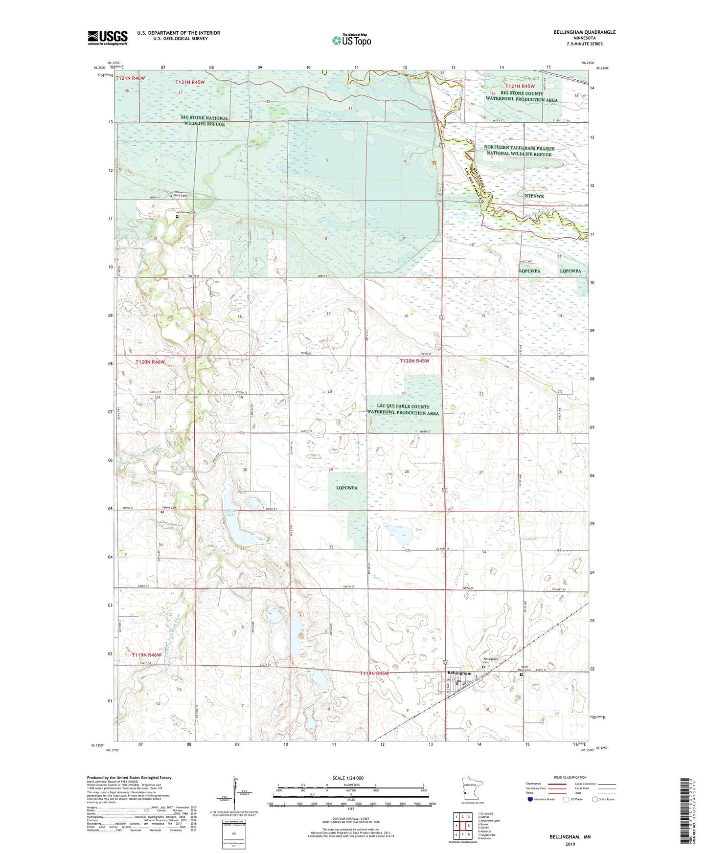
2022 topographic map quadrangle Bellingham in the state of Minnesota. Scale: 1:24000. Based on the newly updated USGS 7.5' US Topo map series, this map is in the following counties: Lac qui Parle, Big Stone. The map contains contour data, water features, and other items you are used to seeing on USGS maps, but also has updated roads and other features. This is the next generation of topographic maps. Printed on high-quality waterproof paper with UV fade-resistant inks.
Quads adjacent to this one:
West: Rosen
Northwest: Ortonville
North: Odessa
Northeast: Artichoke Lake
East: Correll
Southeast: Madison
South: Haydenville
Southwest: Marietta
This map covers the same area as the classic USGS quad with code o45096b3.
Contains the following named places: Bellingham, Bellingham Cemetery, Bellingham Fire Department, Bellingham Post Office, Big Stone Lake-Whetstone River, Big Stone National Wildlife Refuge, Boehnke Slough, City of Bellingham, Highway 75 Dam, Immanuel Cemetery, Immanuel Church, Kibler State Wildlife Management Area, Lac Qui Parle State Wildlife Management Area, Mud Lake, North Fork Yellow Bank River, Saint Pauls Cemetery, Saint Paul's Lutheran Church, Saint Peter's Lutheran Church, Salem Cemetery, School Number 19, School Number 20, School Number 22, School Number 50, School Number 85, South Fork Yellow Bank River, Township of Agassiz, United Methodist Church, Yellow Bank Cemetery, Yellow Bank River, ZIP Codes: 56212, 56276