MyTopo
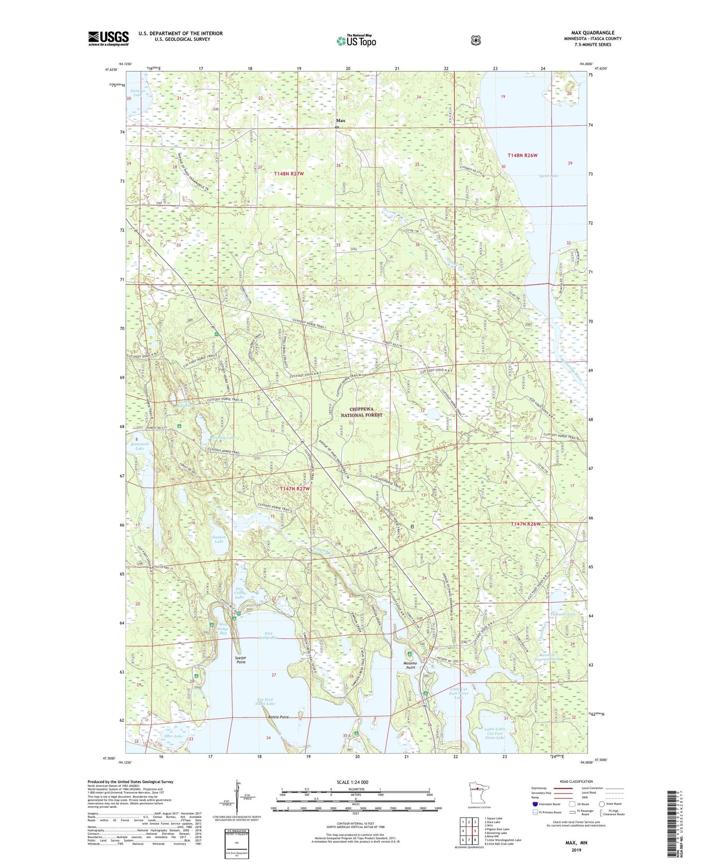
Max Minnesota US Topo Map
Couldn't load pickup availability
Also explore the Max Forest Service Topo of this same quad for updated USFS data
2022 topographic map quadrangle Max in the state of Minnesota. Scale: 1:24000. Based on the newly updated USGS 7.5' US Topo map series, this map is in the following counties: Itasca. The map contains contour data, water features, and other items you are used to seeing on USGS maps, but also has updated roads and other features. This is the next generation of topographic maps. Printed on high-quality waterproof paper with UV fade-resistant inks.
Quads adjacent to this one:
West: Pigeon Dam Lake
Northwest: Squaw Lake
North: Dora Lake
Northeast: Wirt
East: Bowstring Lake
Southeast: Little Ball Club Lake
South: Little Winnibigoshish Lake
Southwest: Bena NW
This map covers the same area as the classic USGS quad with code o47094e1.
Contains the following named places: Amik Impoundment, Amik Lake, Amik Lake Dam, Battle Point, Biauswah Lake, Cut Foot Sioux Lake, Cutfoot Experimental Forest, Cutfoot Sioux National Recreation Trail, Cutfoot Sioux Visitor Information Center, Deer Lake, Deer Lake Campground, Deer River Rest Area, Dinner Creek, Dry Creek Lake, East Seelye Bay, East Seelye Campground, Farley Hill Lookout, Greeley Lake, Lake Roosevelt, Little Cut Foot Sioux Lake, Little Little Cut Foot Sioux Lake, Max, Max Post Office, Mosome Point Camp and Picnic Area, Mosomo Point, North Deer Lake Campground, O-NE-Gum-Me Campground, Sand Lake, Seelye Point, Simpson Creek, Simpson Creek Trail System, Sunken Lake, Turtle Mound Trail, Twomile Creek, Twomile Impoundment, Twomile Lake, West Seelye Bay, West Seelye Campground, Wiiams Narrows Resort and Mobile Home Court, Williams Narrows Campground and Picnic Area