MyTopo
Dora Lake Minnesota US Topo Map
Couldn't load pickup availability
Also explore the Dora Lake Forest Service Topo of this same quad for updated USFS data
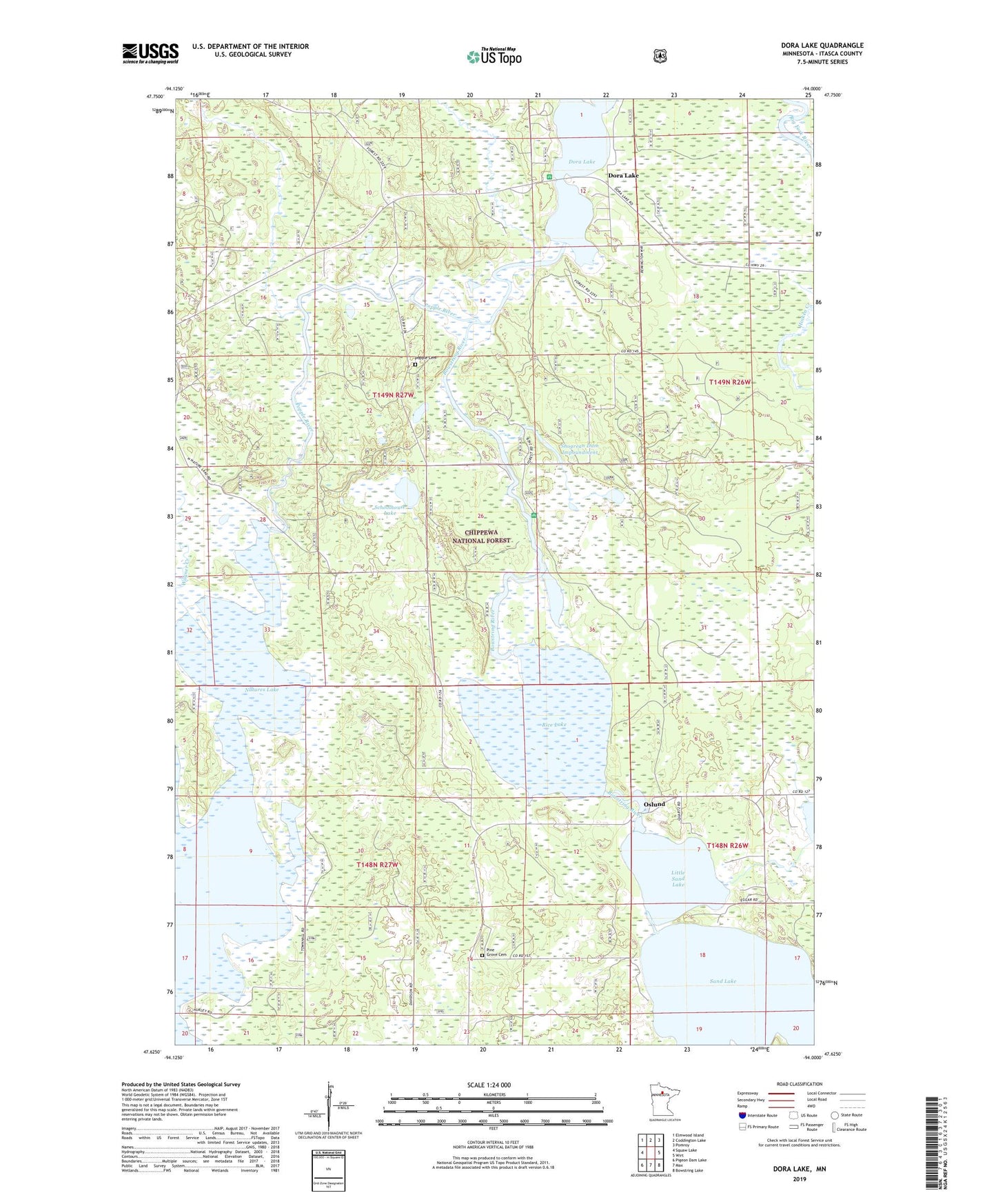
2022 topographic map quadrangle Dora Lake in the state of Minnesota. Scale: 1:24000. Based on the newly updated USGS 7.5' US Topo map series, this map is in the following counties: Itasca. The map contains contour data, water features, and other items you are used to seeing on USGS maps, but also has updated roads and other features. This is the next generation of topographic maps. Printed on high-quality waterproof paper with UV fade-resistant inks.
Quads adjacent to this one:
West: Squaw Lake
Northwest: Elmwood Island
North: Coddington Lake
Northeast: Pomroy
East: Wirt
Southeast: Bowstring Lake
South: Max
Southwest: Pigeon Dam Lake
This map covers the same area as the classic USGS quad with code o47094f1.
Contains the following named places: Bowstring River, Dora Lake, Dora Lake Picnic Area, Dora Lake Post Office, Good News Bible Church, Little Sand Lake, Natures Lake, Oslund, Oslund Post Office, Pine Grove Cemetery, Popple Cemetery, Popple River, Rice Lake, Schoolhouse Lake, Shogrean Dam Impoundment, Shogrean Dam Picnic Area, Township of Kinghurst, Township of Max, Wagner Creek, ZIP Code: 56659