MyTopo
Mayer Minnesota US Topo Map
Couldn't load pickup availability
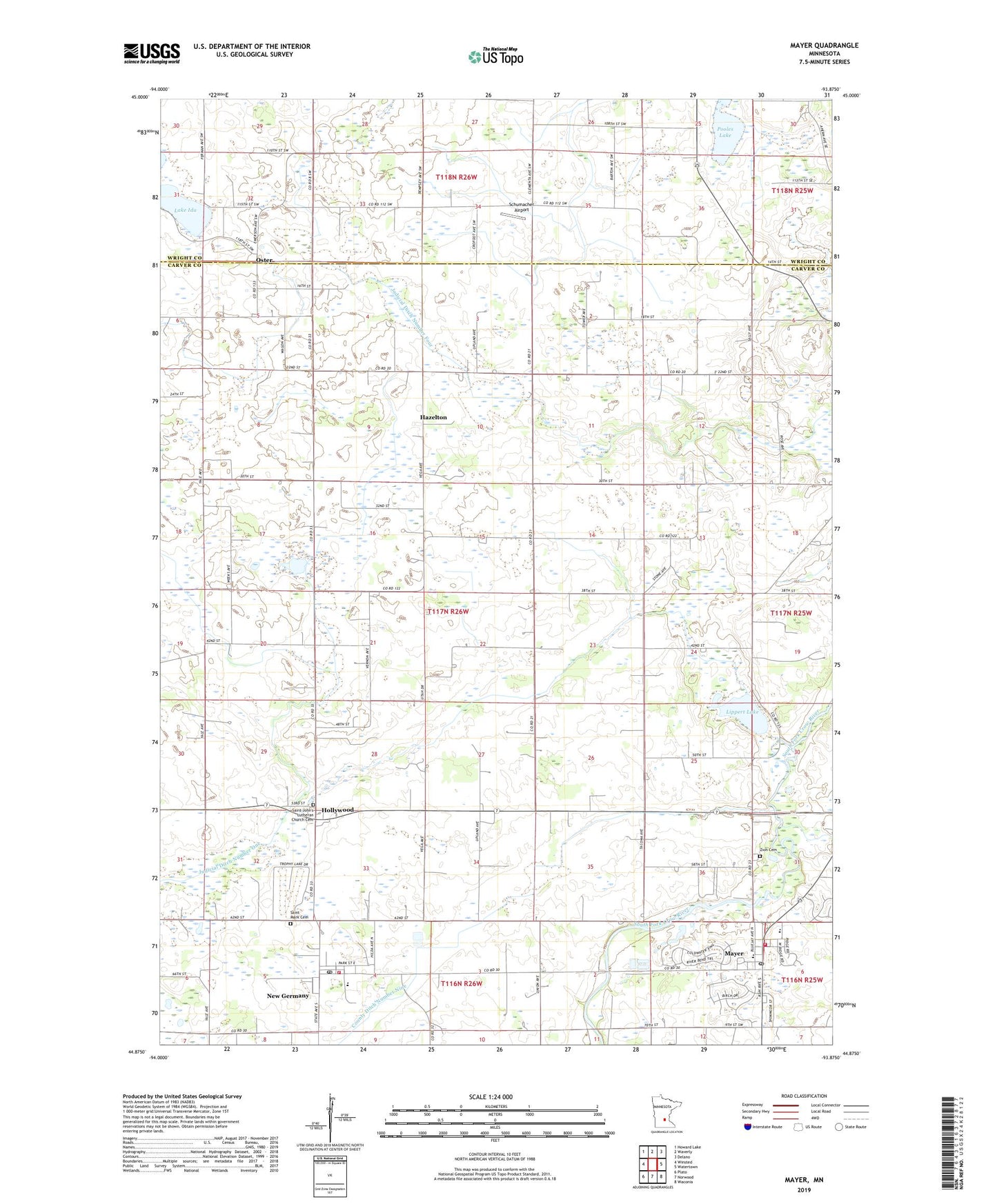
2022 topographic map quadrangle Mayer in the state of Minnesota. Scale: 1:24000. Based on the newly updated USGS 7.5' US Topo map series, this map is in the following counties: Carver, Wright. The map contains contour data, water features, and other items you are used to seeing on USGS maps, but also has updated roads and other features. This is the next generation of topographic maps. Printed on high-quality waterproof paper with UV fade-resistant inks.
Quads adjacent to this one:
West: Winsted
Northwest: Howard Lake
North: Waverly
Northeast: Delano
East: Watertown
Southeast: Waconia
South: Norwood
Southwest: Plato
This map covers the same area as the classic USGS quad with code o44093h8.
Contains the following named places: City of Mayer, City of New Germany, Cobble Crest Lake, Connally School, County Ditch Number Nine, Dobraty School, Hazelton, Hollywood, Hollywood Post Office, Hollywood School, Judicial Ditch Number Four, Judicial Ditch Number One, Lake Ida, Lake Ida School, Lippert Lake, Mayer, Mayer City Hall, Mayer Fire Department, Mayer Lutheran High School, Mayer Post Office, McClelland School, McGrath School, Neaton School, New Germany, New Germany Fire Department, New Germany Post Office, Oster, Oster Post Office, Pooles Lake, Saint John Lutheran Church, Saint John's Lutheran Church Cemetery, Saint Mark Cemetery, Saint Mark Lutheran School, Saint Mark's Lutheran Church, Schumacher Airport, Sells Flying Field, Top Dog Country Club, Township of Hollywood, Ziermann Airport, Zion Cemetery, Zion Lutheran Church, Zion Lutheran School, ZIP Codes: 55360, 55367