MyTopo
McIntosh Minnesota US Topo Map
Couldn't load pickup availability
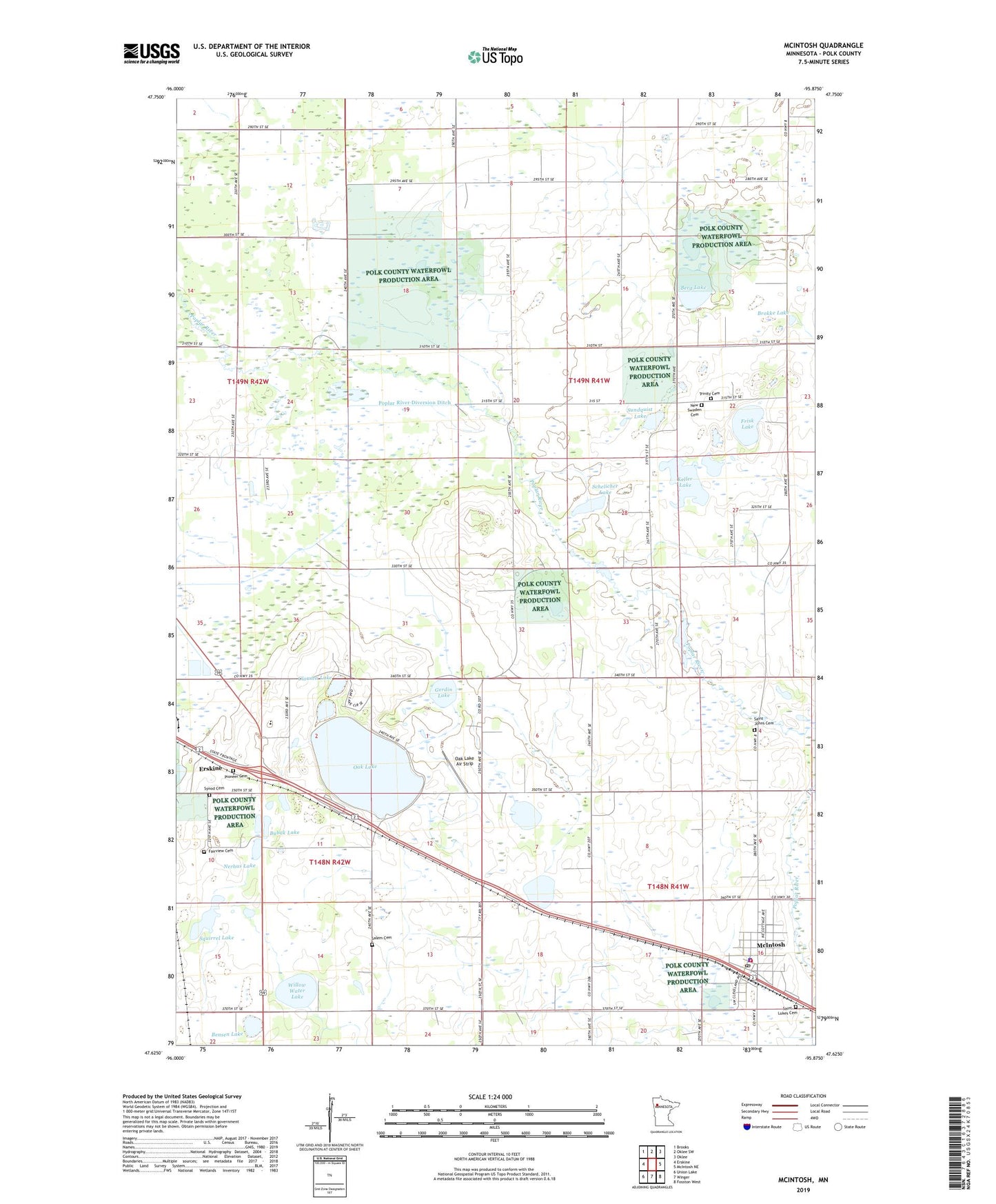
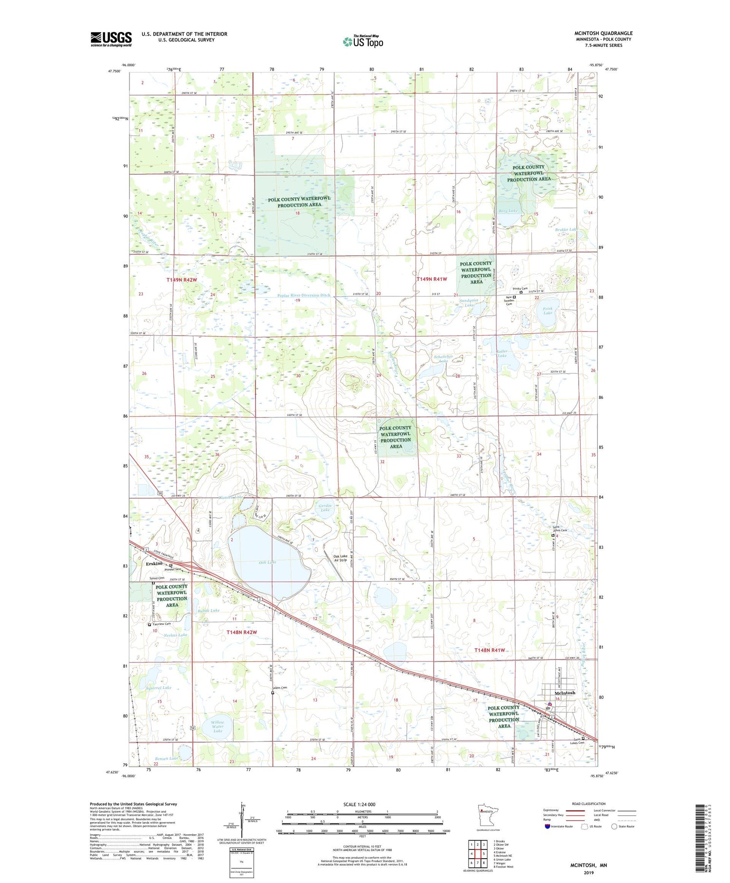
2019 topographic map quadrangle McIntosh in the state of Minnesota. Scale: 1:24000. Based on the newly updated USGS 7.5' US Topo map series, this map is in the following counties: Polk. The map contains contour data, water features, and other items you are used to seeing on USGS maps, but also has updated roads and other features. This is the next generation of topographic maps. Printed on high-quality waterproof paper with UV fade-resistant inks.
Quads adjacent to this one:
West: Erskine
Northwest: Brooks
North: Oklee SW
Northeast: Oklee
East: McIntosh NE
Southeast: Fosston West
South: Winger
Southwest: Union Lake
Contains the following named places: Bartz Mobile Home Park, Bensen Lake, Berg Lake, Brokke Lake, Bubak Lake, City of McIntosh, City of McIntosh Campground, Clausen Lake, Fairview Cemetery, Frisk Lake, Gerdin Lake, Immanuel Lutheran Church, Keller Lake, McIntosh, McIntosh City Hall, McIntosh Manor Nursing Home, McIntosh Police Department, Mcintosh Post Office, McIntosh Public Library, McIntosh Volunteer Fire Department, Nerhus Lake, New Sweden Cemetery, Oak Lake, Oak Lake Air Strip, Oak Lake Outlet Dam, Oak Lake Rest Area, Oppegaard Lake, Our Saviour's Lutheran Church, Pioneer Cemetery, Polk State Wildlife Management Areas, Poplar River Diversion Ditch, Saint Johns Cemetery, Saint Lukes Cemetery, Salem Cemetery, Salem Church, Schelicher Lake, Squirrel Lake, Sundquist Lake, Synod Cemetery, Township of King, Township of Lessor, Trinity Cemetery, Trinity Church, Willewater Post Office, Willow Water Lake, Win-E-Mac Golf Course, ZIP Code: 56556