MyTopo
Winger Minnesota US Topo Map
Couldn't load pickup availability
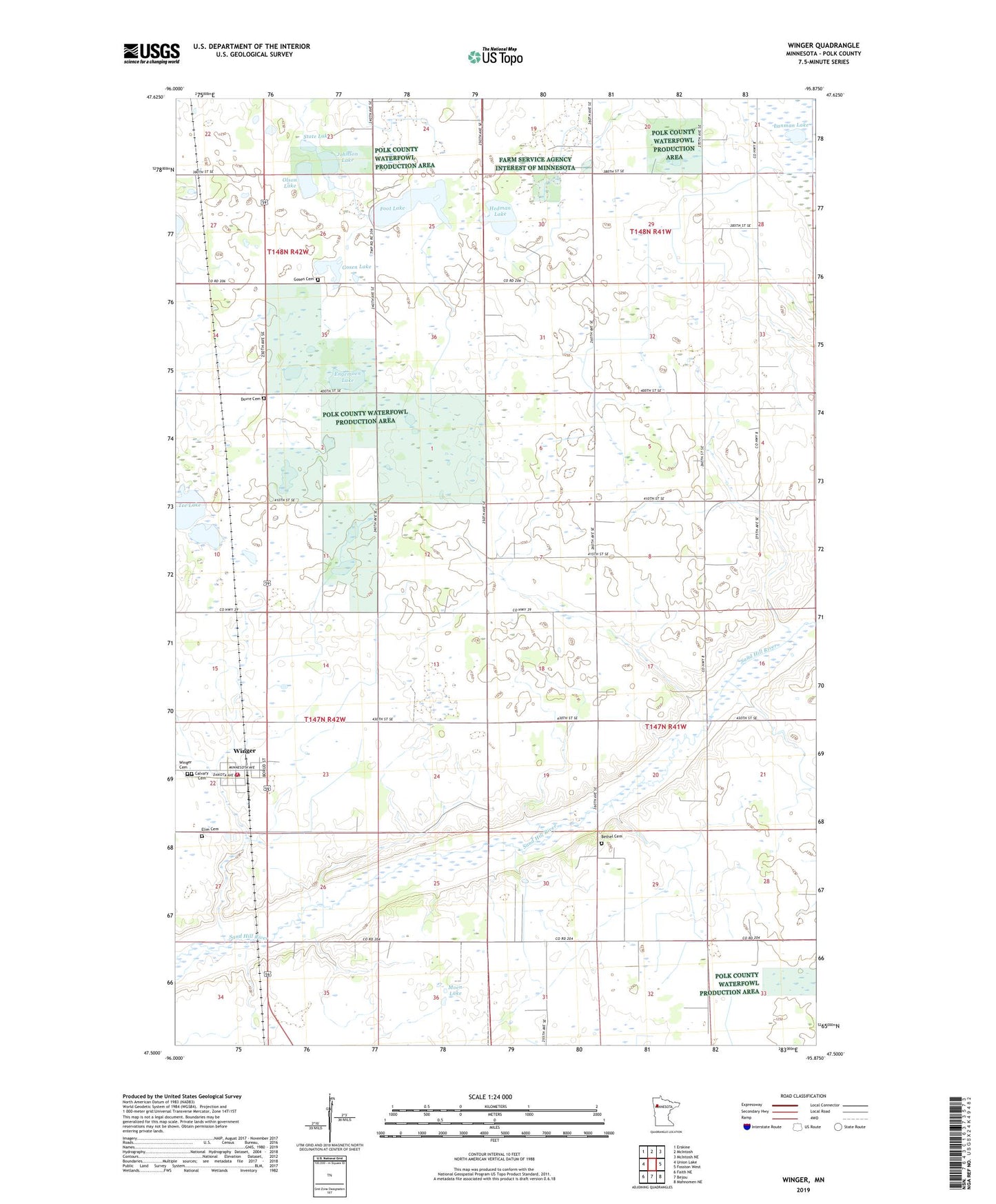
2022 topographic map quadrangle Winger in the state of Minnesota. Scale: 1:24000. Based on the newly updated USGS 7.5' US Topo map series, this map is in the following counties: Polk. The map contains contour data, water features, and other items you are used to seeing on USGS maps, but also has updated roads and other features. This is the next generation of topographic maps. Printed on high-quality waterproof paper with UV fade-resistant inks.
Quads adjacent to this one:
West: Union Lake
Northwest: Erskine
North: McIntosh
Northeast: McIntosh NE
East: Fosston West
Southeast: Mahnomen NE
South: Bejou
Southwest: Faith NE
This map covers the same area as the classic USGS quad with code o47095e8.
Contains the following named places: Bethel Cemetery, Bethel Church, Calvary Cemetery, City of Winger, County Ditch Number Ninetytwo, Dovre Cemetery, Dovre Lutheran Church, Elim Cemetery, Engemoen Lake, Foot Lake, Gosen Cemetery, Gosen Church, Gosen Lake, Hedman Lake, Johnson Lake, Lanman Lake, Moen Lake, Olson Lake, Sletten Post Office, State Lake, Tee Lake, Winger, Winger Cemetery, Winger Police Department, Winger Post Office, Winger Volunteer Fire Department