MyTopo
Merrifield Minnesota US Topo Map
Couldn't load pickup availability
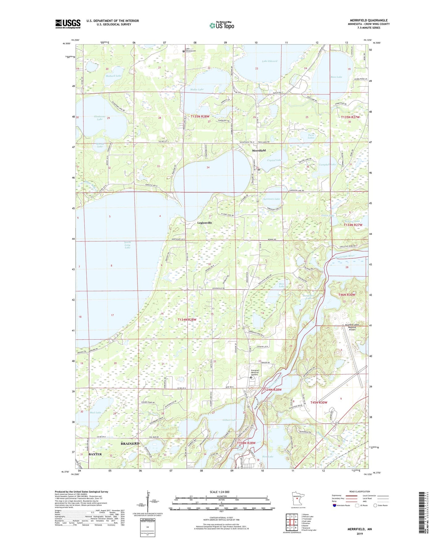
2019 topographic map quadrangle Merrifield in the state of Minnesota. Scale: 1:24000. Based on the newly updated USGS 7.5' US Topo map series, this map is in the following counties: Crow Wing. The map contains contour data, water features, and other items you are used to seeing on USGS maps, but also has updated roads and other features. This is the next generation of topographic maps. Printed on high-quality waterproof paper with UV fade-resistant inks.
Quads adjacent to this one:
West: Gull Lake
Northwest: Nisswa
North: Pelican Lake
Northeast: Trommald
East: Riverton
Southeast: South Long Lake
South: Brainerd
Southwest: Baxter
Contains the following named places: Bass Lake, Brainerd Dam, Brainerd Lakes Regional Airport, Campbell Lake, Community Church of the Nazarene, Crystal Lake, Evergreen Memorial Gardens, Gilbert Lake, Gladstone Lake, Green Lake, Hart's RV Park, Horseshoe Lake, Lake Edward Cemetery, Lazy Acre's Trailer Court, Legionville, Mallard Lake, Memorial Park, Merrifield, Merrifield Census Designated Place, Merrifield Post Office, Mollie Lake, Moody Lake, Mud Lake, North Long Lake, North Memorial Air Care, Pickerel Lake, Rice Lake, Sorensen Lake, Stewart C Mills Senior Field, Sullivan's Resort and Campground, Supreme Mobile Court, Tamarack Lake, Twin Lakes, Unorganized Territory of First Assessment, Unorganized Territory of West Crow Wing, Whiteley Creek