
MyTopo
Millerville Minnesota US Topo Map
Couldn't load pickup availability
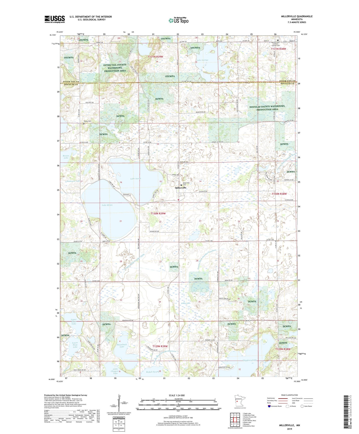
2019 topographic map quadrangle Millerville in the state of Minnesota. Scale: 1:24000. Based on the newly updated USGS 7.5' US Topo map series, this map is in the following counties: Douglas, Otter Tail. The map contains contour data, water features, and other items you are used to seeing on USGS maps, but also has updated roads and other features. This is the next generation of topographic maps. Printed on high-quality waterproof paper with UV fade-resistant inks.
Quads adjacent to this one:
West: Evansville
Northwest: Eagle Lake
North: Inspiration Peak
Northeast: Parkers Prairie NW
East: Lake Miltona West
Southeast: Alexandria West
South: Brandon
Southwest: Quam Lake
Contains the following named places: Anderson Lake, Anderson Lake Dam, Baumbach Lake, Boesen Lake, City of Millerville, City of Urbank, County Ditch Number Fourteen, County Ditch Number Sixty, Lake Aaron, Lake George, Lake Moses, Lower Hunt Lake, Millerville, Millerville Cemetery, Millerville Fire Department, Millerville Post Office, Millerville Sportsman Group Wildlife Structure Dam, Pine Ridge Golf Course, Redick Swamp, Sacred Heart Catholic Church, Sacred Heart Catholic Church Cemetery, Township of Millerville, Trinity Cemetery, Trinity Church, Upper Hunt Lake, Upper Hunt Lake Dam, Urbank, Urbank Post Office, Wilken Lake


