MyTopo
Evansville Minnesota US Topo Map
Couldn't load pickup availability
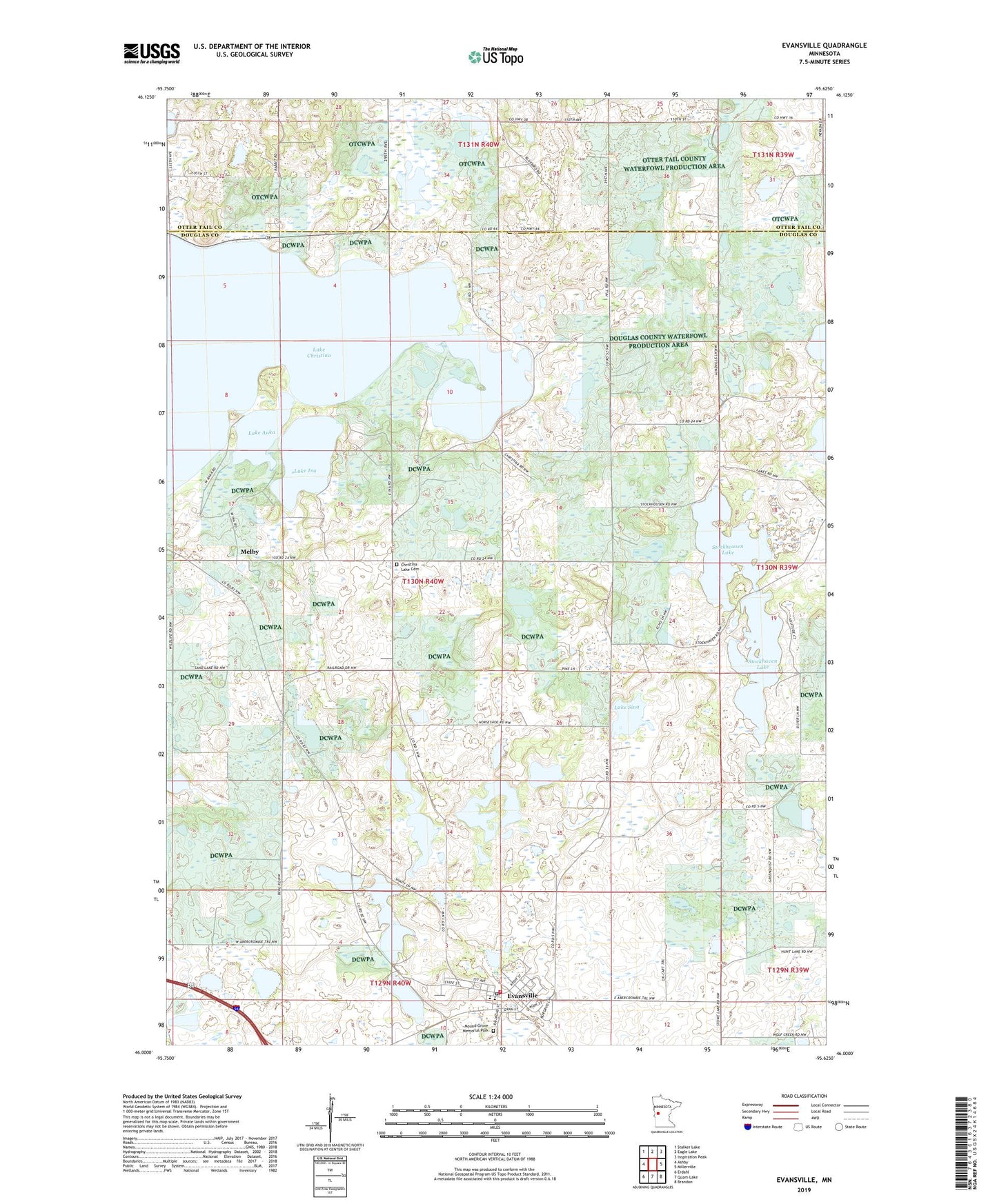
2022 topographic map quadrangle Evansville in the state of Minnesota. Scale: 1:24000. Based on the newly updated USGS 7.5' US Topo map series, this map is in the following counties: Douglas, Otter Tail. The map contains contour data, water features, and other items you are used to seeing on USGS maps, but also has updated roads and other features. This is the next generation of topographic maps. Printed on high-quality waterproof paper with UV fade-resistant inks.
Quads adjacent to this one:
West: Ashby
Northwest: Stalker Lake
North: Eagle Lake
Northeast: Inspiration Peak
East: Millerville
Southeast: Brandon
South: Quam Lake
Southwest: Erdahl
This map covers the same area as the classic USGS quad with code o46095a6.
Contains the following named places: Balgaard State Wildlife Management Area, Christina Lake Cemetery, Christina Lake Church, Chuck West Memorial Heliport, City of Evansville, Covenant Church, Crestview Manor Health Care, Douglas County Waterfowl Production Area, Eagle Lake State Wildlife Management Area, Elmer Airport, Evansville, Evansville Fire Department, Evansville Post Office, Faith Lutheran Church, Horseshoe Lake, Lake Anka, Lake Christina, Lake Ina, Lake Sina, Mahla Lakes, Melby, Melby Post Office, Mound Grove Memorial Park, Stockhaven Lake, Stockhousen Lake, Thornberg State Wildlife Management Area, Township of Lund, ZIP Code: 56326