MyTopo
Eagle Lake Minnesota US Topo Map
Couldn't load pickup availability
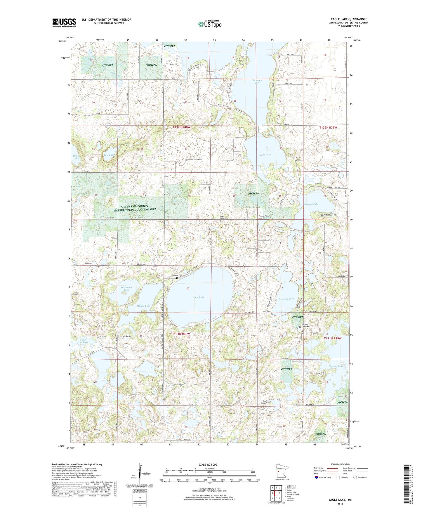
2022 topographic map quadrangle Eagle Lake in the state of Minnesota. Scale: 1:24000. Based on the newly updated USGS 7.5' US Topo map series, this map is in the following counties: Otter Tail. The map contains contour data, water features, and other items you are used to seeing on USGS maps, but also has updated roads and other features. This is the next generation of topographic maps. Printed on high-quality waterproof paper with UV fade-resistant inks.
Quads adjacent to this one:
West: Stalker Lake
Northwest: Underwood
North: Battle Lake
Northeast: Vining
East: Inspiration Peak
Southeast: Millerville
South: Evansville
Southwest: Ashby
This map covers the same area as the classic USGS quad with code o46095b6.
Contains the following named places: Axel Post Office, Belmont Lake, Crane Lake, Eagle Lake, Eagle Lake Cemetery, Eagle Lake Church, Evander Cemetery, Free Church Cemetery, Grue Cemetery, Grue Church, Hancock Lake, Hoff Post Office, Middle Lake, Oak Hill Farm Cemetery, Pete Lake, School Number 1398, School Number 1418, Spitzer Lake, Torgerson Lake, Township of Clitherall, Township of Eagle Lake, Trefoldighed Minighed Church