MyTopo
Millville Minnesota US Topo Map
Couldn't load pickup availability
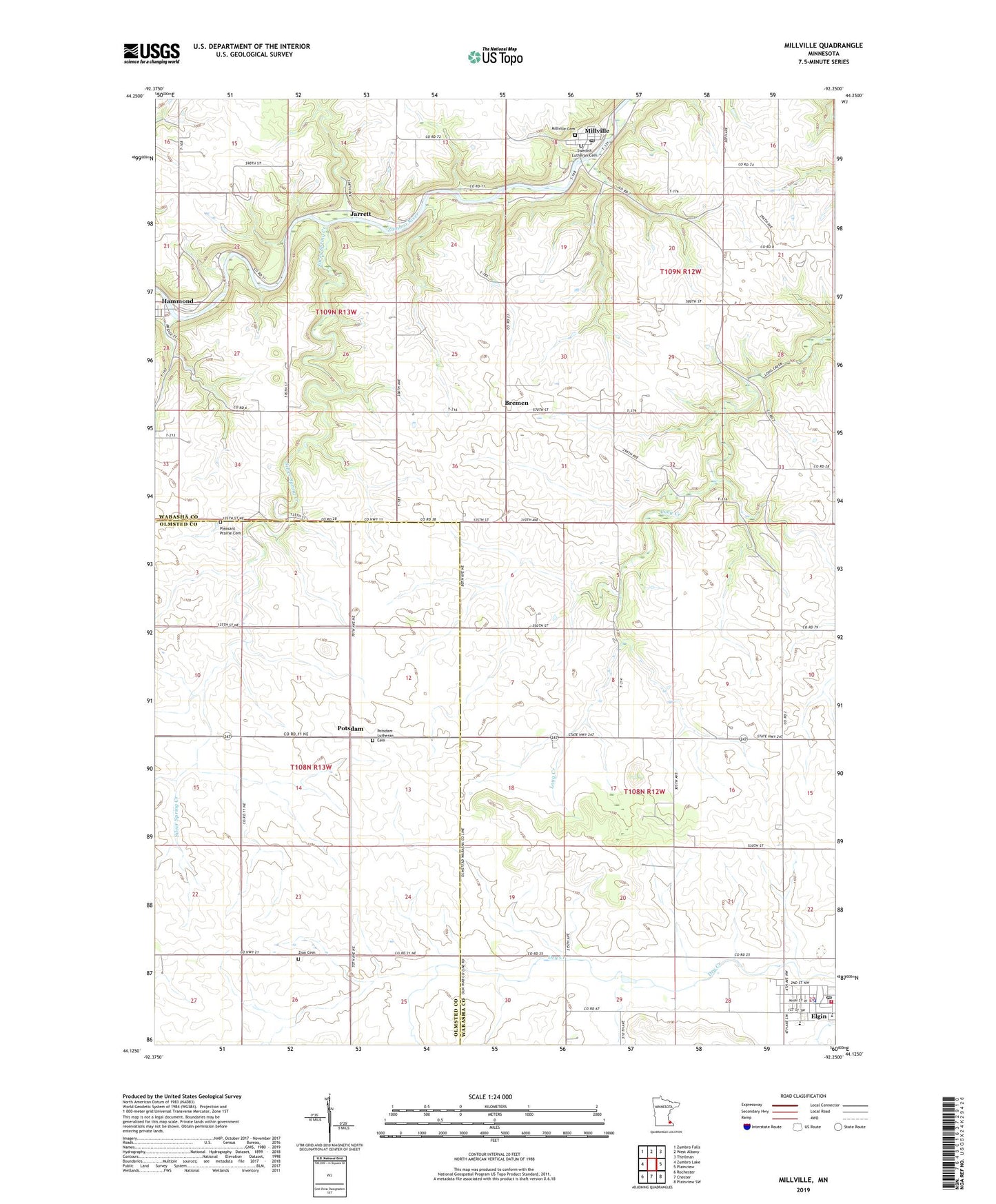
2022 topographic map quadrangle Millville in the state of Minnesota. Scale: 1:24000. Based on the newly updated USGS 7.5' US Topo map series, this map is in the following counties: Wabasha, Olmsted. The map contains contour data, water features, and other items you are used to seeing on USGS maps, but also has updated roads and other features. This is the next generation of topographic maps. Printed on high-quality waterproof paper with UV fade-resistant inks.
Quads adjacent to this one:
West: Zumbro Lake
Northwest: Zumbro Falls
North: West Albany
Northeast: Theilman
East: Plainview
Southeast: Plainview SW
South: Chester
Southwest: Rochester
This map covers the same area as the classic USGS quad with code o44092b3.
Contains the following named places: Bremen, Bremen Church, Bremen Post Office, City of Elgin, City of Hammond, City of Millville, De Frang Pooling Agreement Dam, Elgin, Elgin Ambulance, Elgin Fire Department, Elgin High School, Elgin Police Department, Elgin Post Office, Elgin-Millville Elementary School, Grace United Church of Christ, Hammond, Hammond Post Office, Hilltop Fellowship Church, Jarrett, Jarretts Post Office, Millville, Millville Cemetery, Millville Fire Department, Millville Post Office, Oakwood Church, Pleasant Prairie Cemetery, Potsdam, Potsdam Lutheran Cemetery, Potsdam Post Office, Saint Patrick's Catholic Church, Silver Spring Creek, Spring Creek Motorcross Park, Swedish Lutheran Cemetery, Township of Elgin, Trinity Lutheran Church, Zion Cemetery, ZIP Codes: 55932, 55957