MyTopo
Zumbro Lake Minnesota US Topo Map
Couldn't load pickup availability
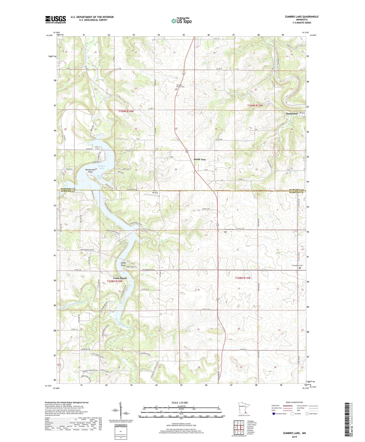
2022 topographic map quadrangle Zumbro Lake in the state of Minnesota. Scale: 1:24000. Based on the newly updated USGS 7.5' US Topo map series, this map is in the following counties: Olmsted, Wabasha. The map contains contour data, water features, and other items you are used to seeing on USGS maps, but also has updated roads and other features. This is the next generation of topographic maps. Printed on high-quality waterproof paper with UV fade-resistant inks.
Quads adjacent to this one:
West: Oronoco
Northwest: Mazeppa
North: Zumbro Falls
Northeast: West Albany
East: Millville
Southeast: Chester
South: Rochester
Southwest: Douglas
This map covers the same area as the classic USGS quad with code o44092b4.
Contains the following named places: Cedar Beach, Dry Run Creek, Farm Hill Cemetery, Greenland Cemetery, Kings Park, Lake Zumbro Seaplane Base, Middle Fork Zumbro River, Nietz Airstrip, Pleasant Prairie Cemetery, Rattlesnake Point, Ryans Bay, Sandy Point, South Fork Zumbro River, South Troy, South Troy Post Office, Tiedeman Farms, Township of Farmington, Township of Oronoco, Township of Zumbro, Woodland Camp, Woodville Chapel, Zumbro Lake, Zumbro Lake Dam