MyTopo
Moland Minnesota US Topo Map
Couldn't load pickup availability
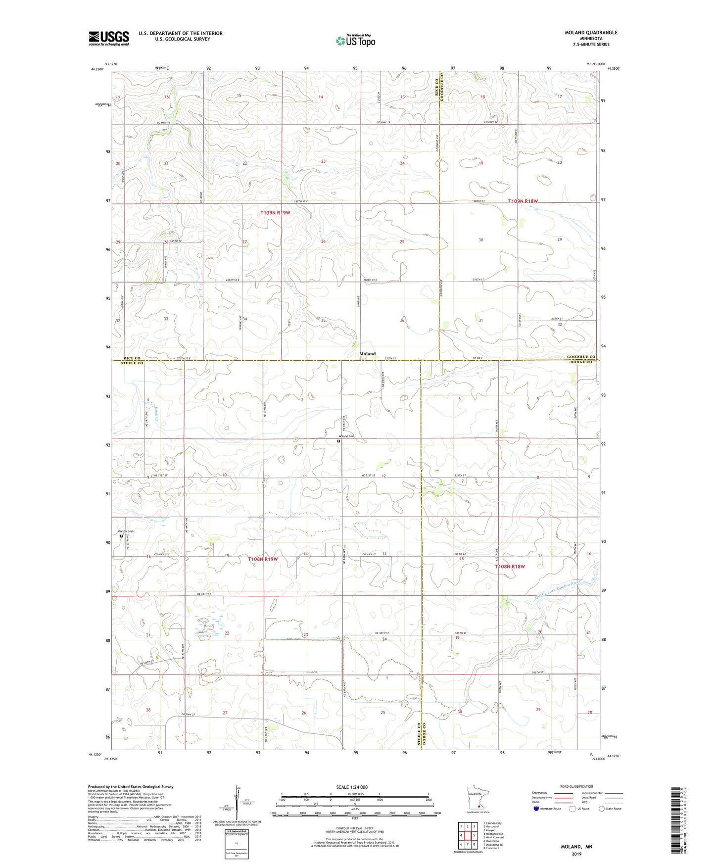
2019 topographic map quadrangle Moland in the state of Minnesota. Scale: 1:24000. Based on the newly updated USGS 7.5' US Topo map series, this map is in the following counties: Steele, Rice, Dodge, Goodhue. The map contains contour data, water features, and other items you are used to seeing on USGS maps, but also has updated roads and other features. This is the next generation of topographic maps. Printed on high-quality waterproof paper with UV fade-resistant inks.
Quads adjacent to this one:
West: Medford East
Northwest: Cannon City
North: Nerstrand
Northeast: Kenyon
East: West Concord
Southeast: Claremont
South: Owatonna SE
Southwest: Owatonna
Contains the following named places: County Ditch Number Two, Merton Cemetery, Moland, Moland Cemetery, Moland Church, Richland Center School, Township of Merton, Township of Richland